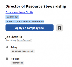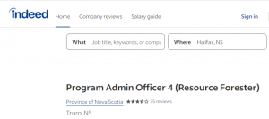
Click on image to go to the advertisement on indeed,com
It’s difficult for the public to find much out about ” who does what at NRR” – the positions that exist at NRR, the overall hierarchy, and what individuals/the department accomplish and plan in a particular year. There are no comprehensive directories, no annual reports. To be fair, this statement may apply to most departments under both the current and previous governments.
One small insight as to direction the NRR is taking is given by the public advertisements to fill vacancies or new positions. That’s all we get; there are no, or rarely, any announcements about who actually fills a position, or about what they do down the line.
I did manage to find an organizational chart for Lands and Forestry in a 2018 FOIPOP document which helped for a while when I was writing NS Forest Notes, Under the new PC Government there has been a lot of reorganization, so it’s no longer helpful.
When I do see a job advert for an upper level position in the Forestry Section of NRR that seems to provide some info, I post it. I do so partly as a matter of record, but also to help advertise the position. So here are some excerpts from the latest (from indeed.com)
Program Admin Officer 4 (Resource Forester)… Read more on www.versicolor.ca/nstriad