
Distribution of forest in 5 development stages across Nova Scotia, compiled from NS Landscape Map Viewer. Purple = Multi-aged/Old Forest. View larger versions of the map: 2000 px | 4000 px.
(You may have to Save the larger image and open it on your device to view at full size).

Forest Merchatable Volumes, compiled from NS Landscape Map Viewer. View 2500 px map 5000 px Map; 11000 px map (You may have to Save the larger images and open them on your device to view at full size).

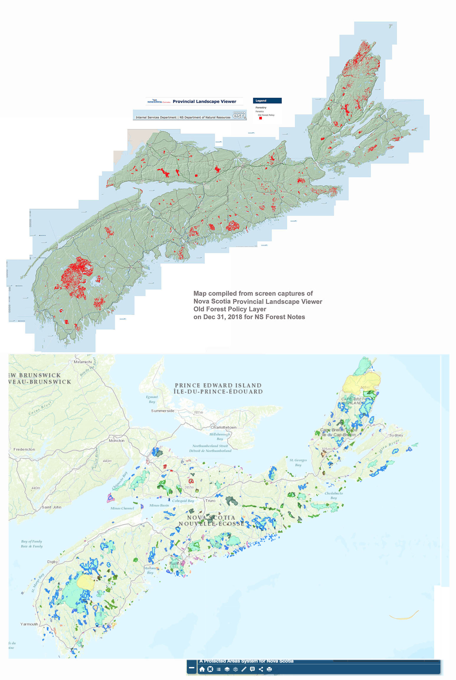
Old Forest Policy Map above and PPAs below. Click on map for larger version.
———
Some updates Oct 7, 2021
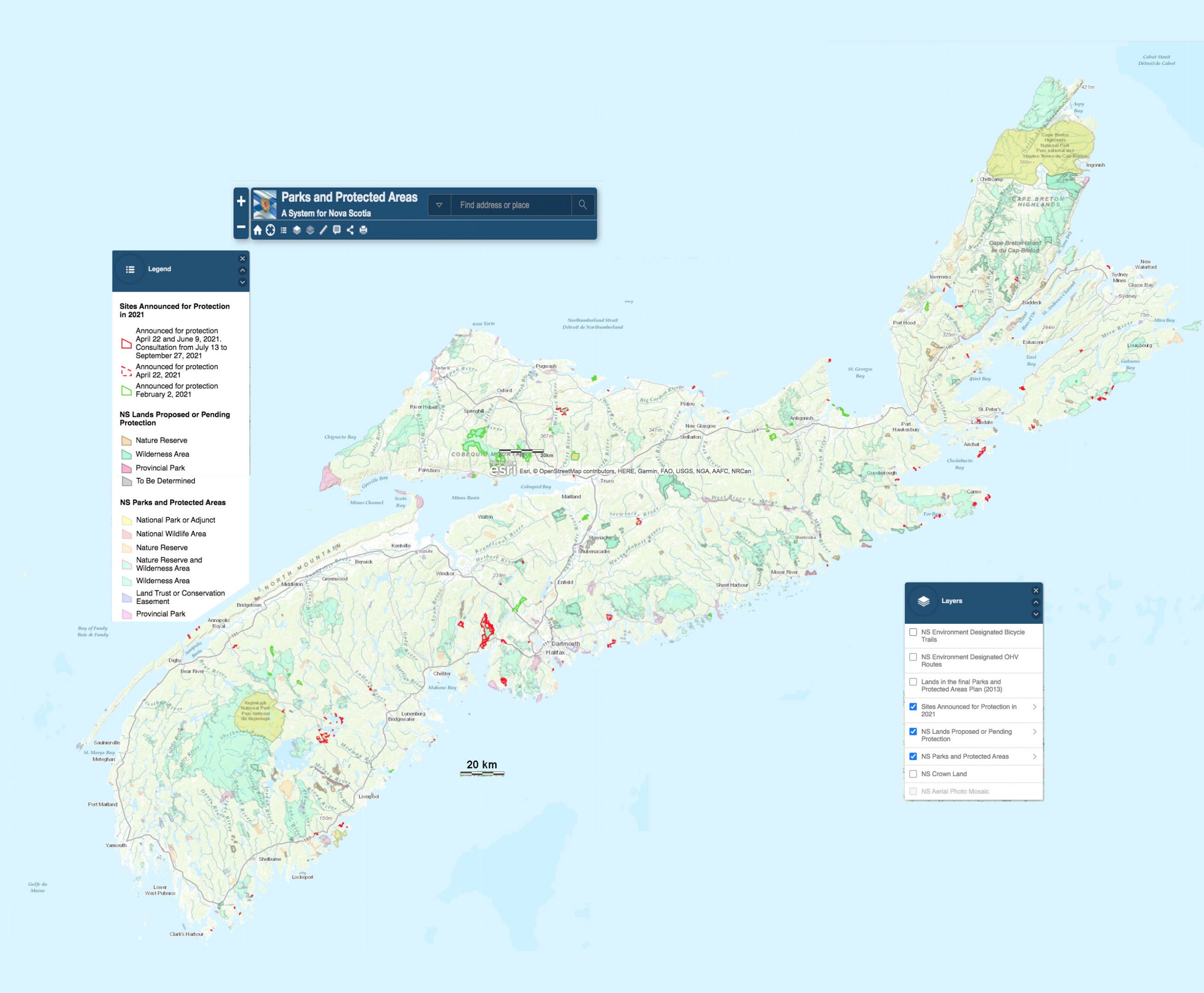
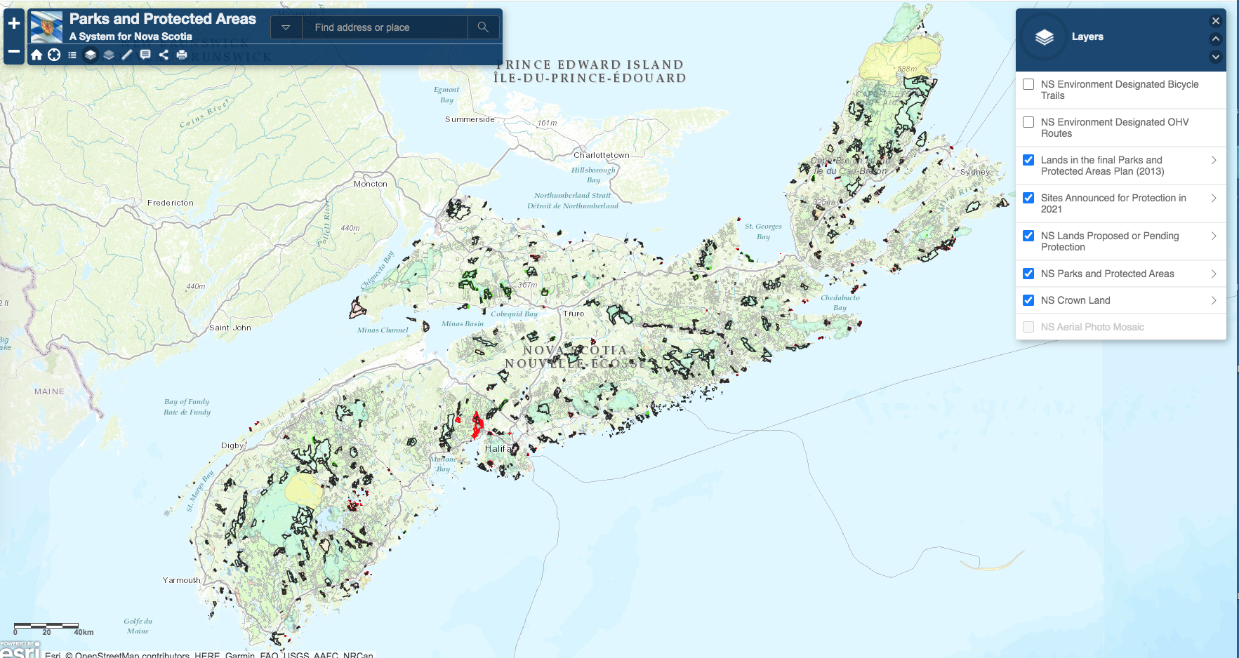
From NSE Parks and Protected Areas: Protected areas interactive map 2616 x 2197 px Screen Captures Oct 6, 2021““`
Options:
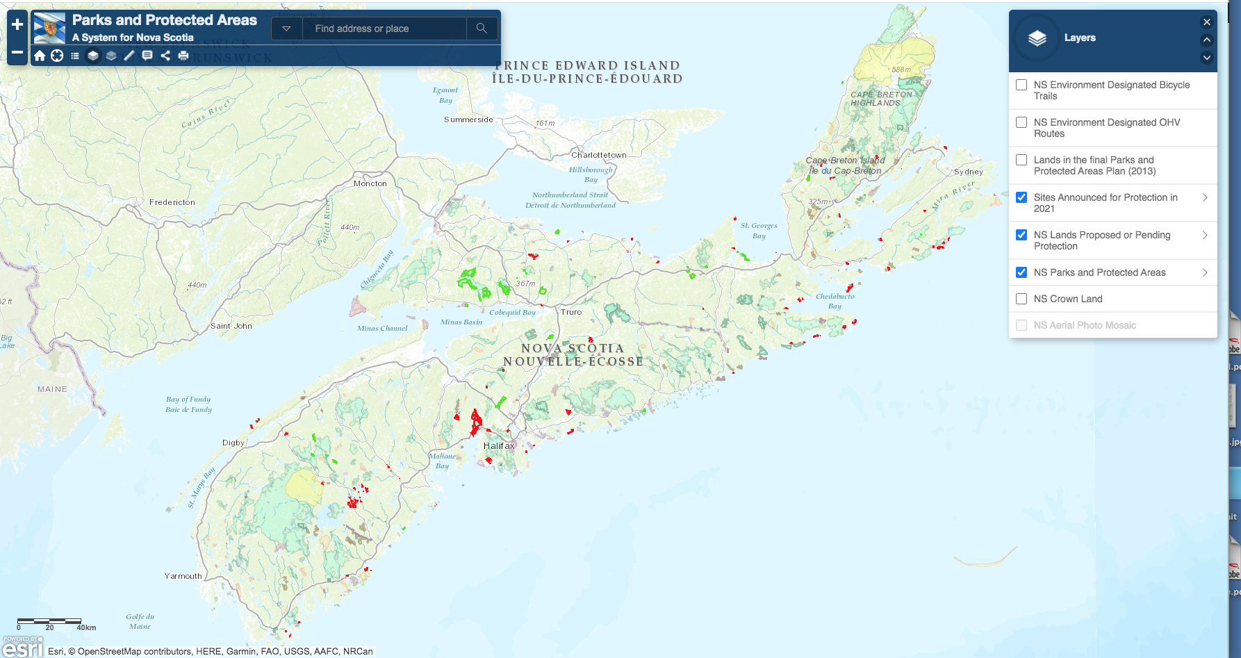
These screen captures (Oct 7, 2021) are all 1786×947 px
The Basic 3 (given by dafault)
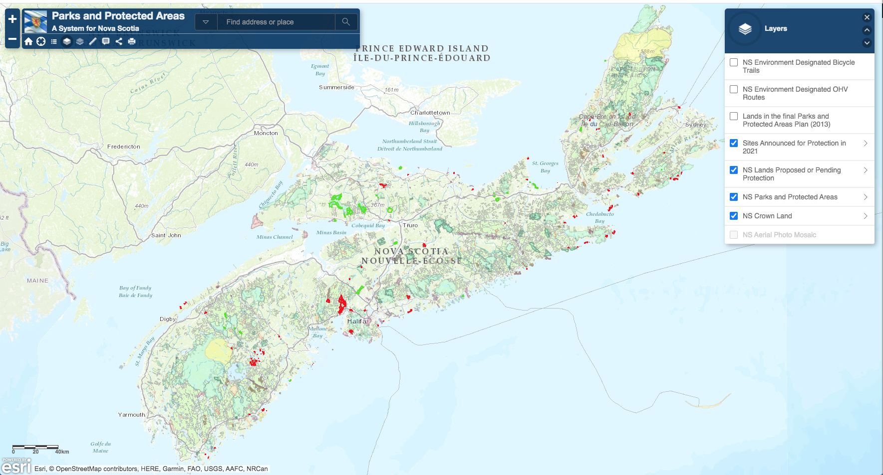
Crown lands added
Added
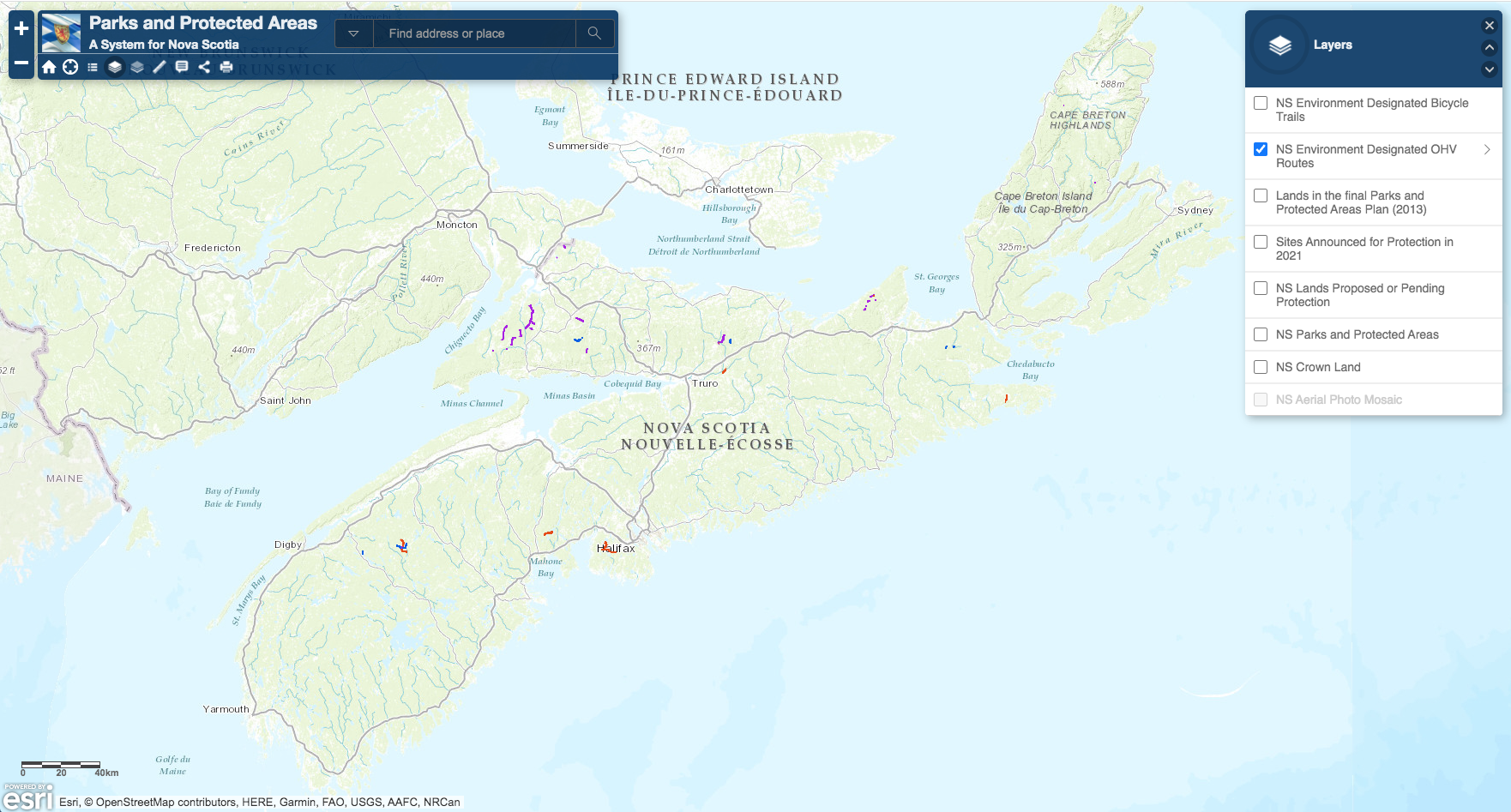
Just OHV routes
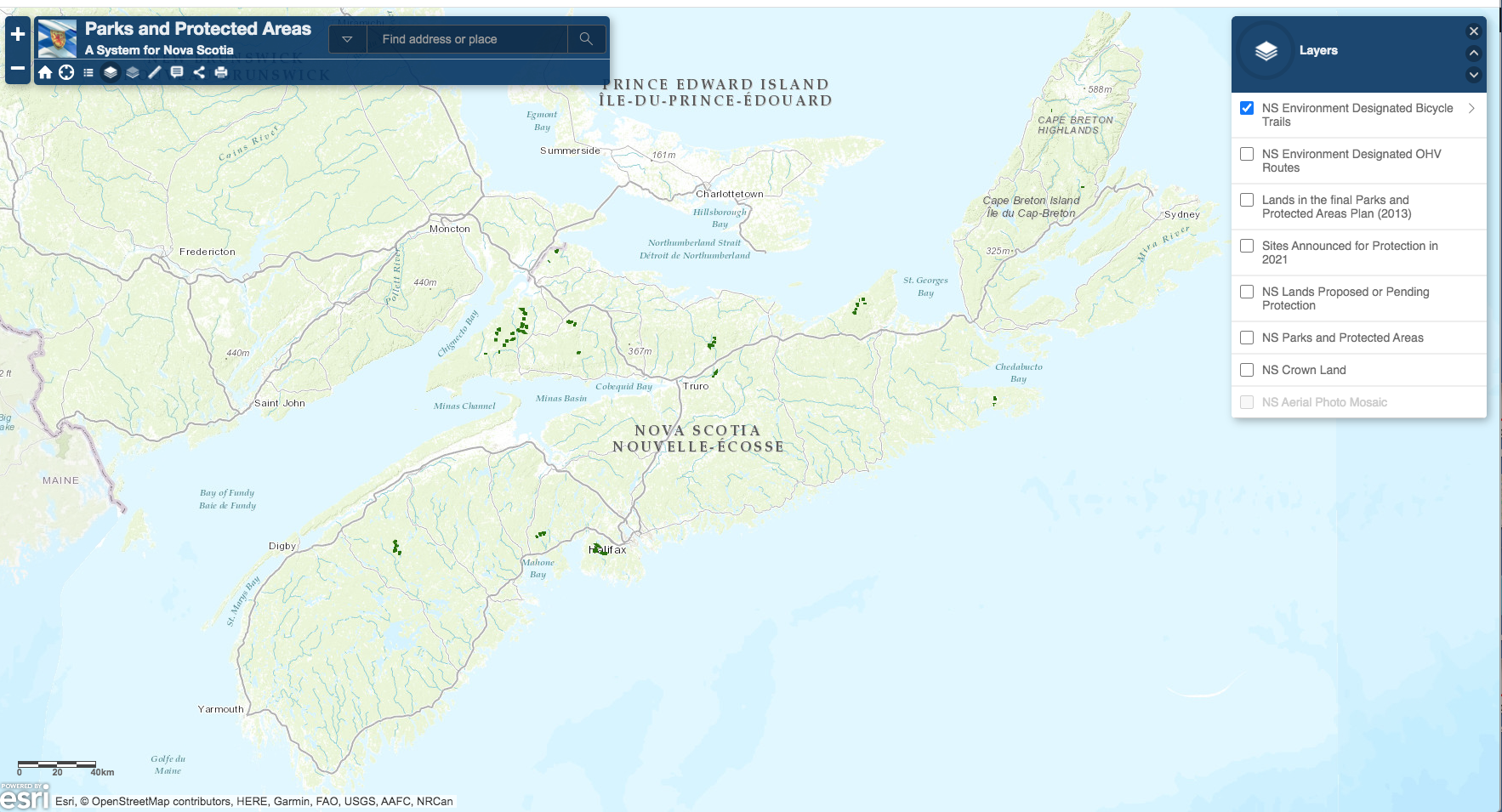
Just Bike Routes
—-
Colour-Me-In
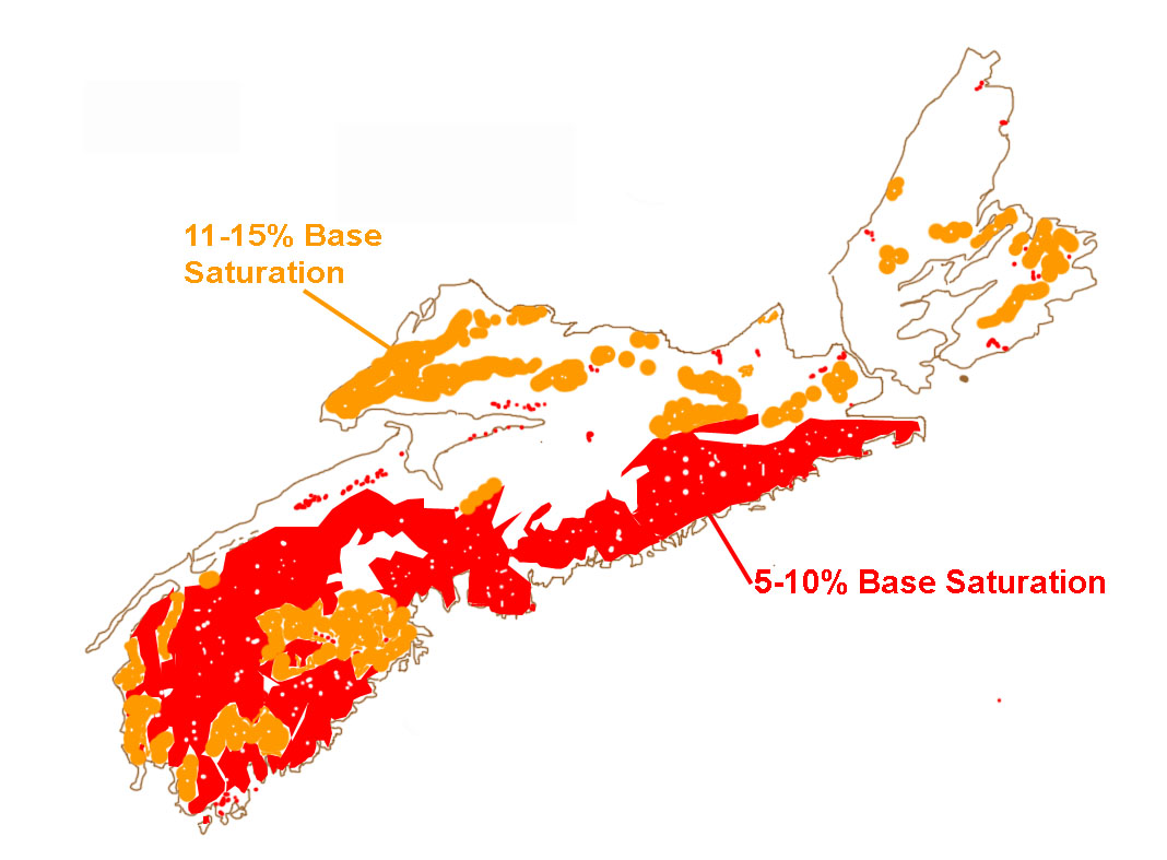
1068×787; drawing after Keys et al. (2016)Fig 3