From Extinction Rebellion Mi’kma’ki / Nova Scotia Mar 16, 2022
For better and worse, those of us with data get emails at camp. The latest list of proposed cuts on ‘crown’ land showed up in our mailboxes a couple of days ago. These lists are sent out by the Department of Natural Resources and Renewables every 10 days.
There’s a sense of dread as you open up the PDF. Which parts of Mi’kma’ki are up for destruction next? The list is broken down by county. This time Annapolis County is taking the biggest hit. 340 hectares. To find out where exactly they are, you have to open up the Harvest Plan Map Viewer.
For those who don’t know, the Harvest Plan Map Viewer is a provincial website. It shows the most recent proposed cuts on ‘crown’ land, that is to say, cuts you can still comment on. Generally the comment period lasts 40 days. So the deadline for commenting on these newest cuts is April 23rd.
Isn’t that nice, that the province is asking us for our opinion on cuts proposed for public lands? You can only submit your comments through this portal but hey, some of us have good enough internet to use this site.
So there you are, ready to comment. But wait. « The intent of the Harvest Plans Map Viewer is to seek information currently not known to the department at a site level that is being proposed for harvest. If your comment provides information about the proposed harvest plan that is specific to the site, the department may contact you for further detail. »
In other words, if your concerns are about the impact of the proposed cut on wildlife, climate change, biodiversity, downstream flood damage or indeed anything that pays no attention to arbitrary site boundaries, well, we don’t want to hear it.
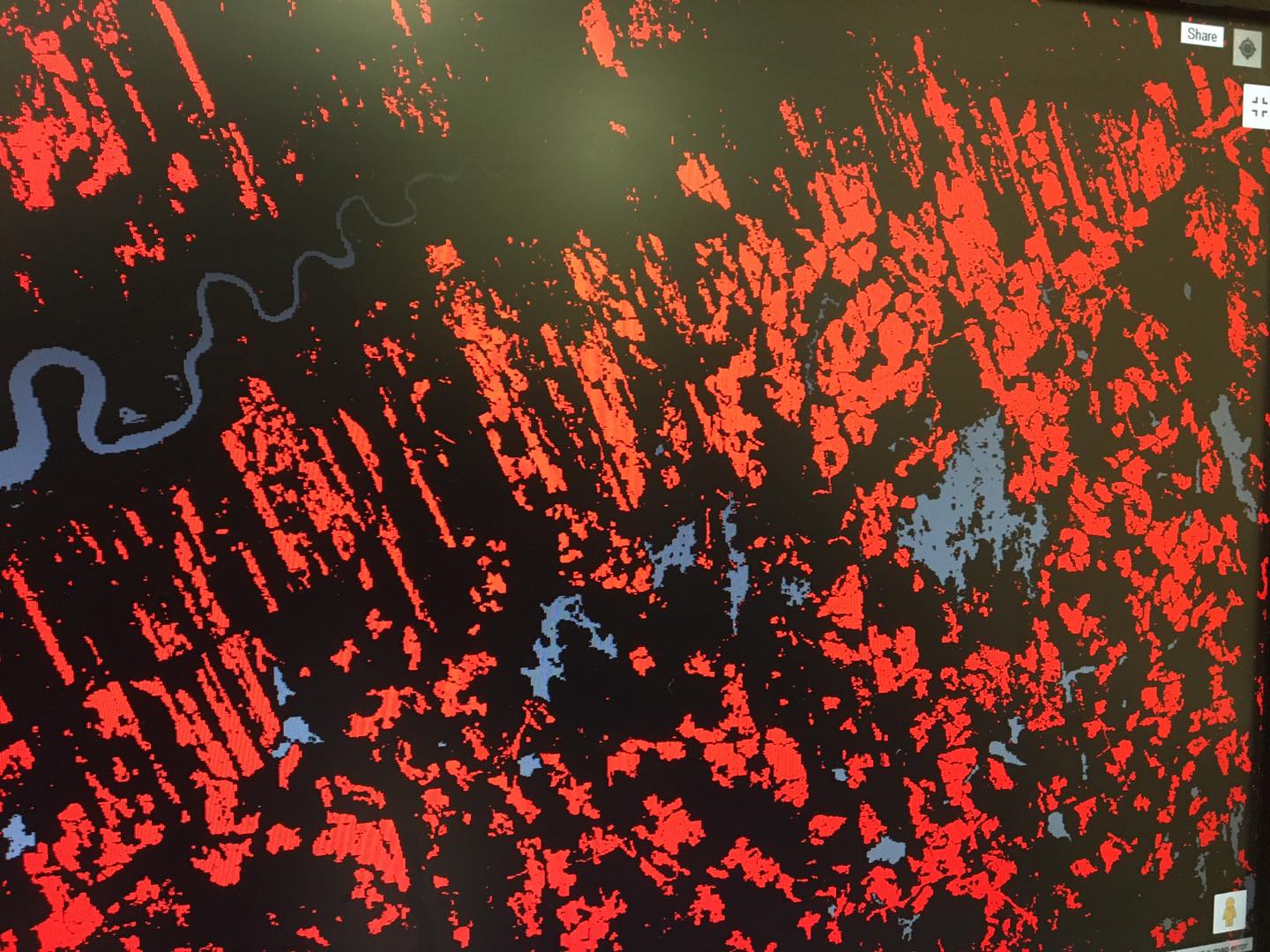
Of those 340 hectares up for the chop in Annapolis County, 238 ha are on the west side of Goldsmith Lake. Goldsmith Lake is one of the few areas on the South Mountain that still has intact areas of old forest. Another such area is around McEwan Lake, just to the northeast of camp.
To get an idea of how precious these areas are, take a look at the Global Forest Watch map of this section of the South Mountain west of Highway 10. The red patches show forest cover lost between 2000 and 2020. Clearcutting has ravaged this landscape. The few areas of solid green, including those around Goldsmith and McEwan Lake, must be protected. Like our little Last Hope forest, they should never have been made available for harvesting. But the province doesn’t want to hear that.
What should be cause for celebration, a shift finally from the gobbledygook ’Interim Retention Guidelines’ to cuts based on the new ‘Silvicultural Guide to the Ecological Matrix’, is not. Why? Because the landscape level planning recommended by the Lahey report is not happening.
Some of the proposed cuts on the newest list are, refreshingly, compatible with ecological forestry. Individual tree harvests and irregular Shelterwood cuts are a definite improvement (if properly carried out), but only if they are conducted in forests that belong in the Ecological Matrix in the first place. If the forest should be in the Protected area where no cutting is allowed, well then no cut is a good cut.
This is not rocket science. If the province is not open to reasonable comment from concerned citizens, then some of those citizens will find other peaceful, non- violent ways to protect what should be protected. Many more citizens will support them in a myriad ways. It’s been 15 weeks. We are still here. Why? Because enough is enough.