
Nova Scotian forests appear to be the most intensively harvested in Canada, recently and historically – on the poorest soils
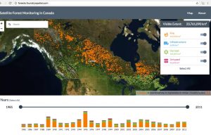
Opening page for interactive map at forests.foundryspatial.com/
The Canadian Forest Service of Natural Resources Canada, in partnership with University of British Columbia, and support from the Canadian Space Agency has developed an interactive Satellite Forest Monitoring Map showing changes in forest cover associated with fire, infrastructure, harvest and in an “Untyped” category for all of Canada over the interval 1985 to 2011.
From the associated Technical Report:
These data represent the most detailed depiction of forest change at the national scale that has ever been generated for Canada (30 metre pixels) with annual depictions of forest change by disturbance type (e.g., fore, harvest). The website allows users to zoom in an out to look at disturbance by type and year or range of years. (SOURCE: HIGH RESOLUTION SATELLITE FOREST MONITORING IN CANADA: A PILOT WEBSITE, Michael Wulder et al. June 2016 DOI: 10.13140/RG.2.1.1706.9680, posted on researchgate.net )
I found the map and tools exceptionally easy to use.
A few things stood out when I viewed the map for all of Canada:
(i) There is a sweep of orange from the Alaskan border to Newfoundland corresponding to the boreal forest, the orange representing fires; (ii) below that band there is a sweep of green corresponding to forest harvests from BC to NS but interrupted in the prairies; and (iii) overall, the density of harvesting increases from west to east.

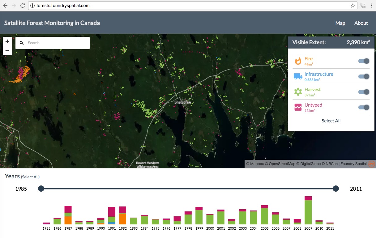
Section of land just south of New Glascow, Nova Scotia, from map at forests.foundryspatial.com
Click on image for larger version.
When I zoomed in, I could find no area with a higher density of forest harvests than in central/eastern Nova Scotia. For a 3065 km2 area just south of New Glascow, 1202 km2 were harvested between 1985 and 2011, i.e. more than 1/3rd of the total area (not just the working forest) in 27 years.
Over the same interval, large blocks of the Western Crown Lands in western Nova Scotia have seen very little harvesting – no wonder the industrial forestry folks in Nova Scotia (with the full cooperation of NSDNR) are anxious to fill in the map.
Section of land in SW Nova Scotia (including a lot of Crown land) from map at forests.foundryspatial.com
Click on image for larger version.
As well as being at the top or very near the top of intensive forest harvesting in Canada since 1985, Nova Scotia is likely at the top or very near the top historically.
Forest ecologist Barrie Goldsmith estimated in 1980* that Nova Scotian forests had been cut over four times since the settlers arrived up to 1970, and we must now be close to or past the time for a 5th cut.
Perhaps that would be sustainable on rich topsoils, but it’s not in Nova Scotia, Goldsmith noting:
The province has one of the longest histories of logging in North America and some of the most nutrient-deficient soils. If any region is likely to experience a serious nutrient depletion problem it is Nova Scotia.
Goldsmith cited seven lines of evidence that Nova Scotian forests had deteriorated and warned that “there is a real risk that options for the future are being reduced.”
Almost 40 years later, and with evidence showing continued degradation of the forests and the soils, we still have not come to terms with those realities.
The best we can come up with, it appears, for a “healthy primary forest industry and the by-products it provides” is to create “value added” products from degraded forests while claiming that “all harvest treatments are aligned with the nature-based requirements of Nova Scotia’s lands“.
Perhaps a national perspective as offered by the interactive Satellite Forest Monitoring Map , the National Forestry Database and the Natural Resources Canada GHG Calculator can help us to re-set before we truly have only one option (value added products from degraded forests) left.
Another national perspective that illustrates the particularly dire state of Nova Scotian forests: “We spend 80 to 150 years growing a tree in Canada – some of the longest growth rates in the world”… so said Dr. Trevor Stuthridge of FP innovations.
I wish we spent 80 to 150 years growing a tree in Nova Scotia, but we long ago learned to do it in 50 years or less.
“You can’t grow a 150 year-old tree in 50 years.”
Comment by an elder forester when the Stanfield government held hearings in Cumberland Co. in the early 1960s to promote its plans to clearcut in support of a new pulp mill planned for Pictou and told woods people, “Now you will be able harvest every 50 years”. (Source: an elder from Parrsboro area).
And so we did.
*F.B. Goldsmith. 1980. An evaluation of a forest resource- a case study from Nova Scotia. Journal of Environmental Management v10, pages 83-100.
——
A tip of the hat to The Tree Frog News Feb 10, 2017, which had a Special Feature about the “Interactive Map of Canada’s Changing Forests”.
Pingback: Nova Scotia Government responds to Questions about the Sustainable Forest Harvest Level 16Oct2024 | Nova Scotia Forest Matters