
& Annapolis County’s Crown lands continue to be heavily logged & L&F seems to have been blind to issues with internet connections in rural areas which can prevent comments being submitted via the Map Viewer
Received today:
Forestry Maps <forestrymaps@novascotia.ca>
To: Forestry Maps. Fri., Jun. 4 at 1:25 p.m.Starting June 2, 2021, only emails submitted using the comment function on the Harvest Plans Map Viewer will be considered during the harvest plan review process. For additional help on how to make a comment please see the “HELP” link at the top of the Harvest Plans Map Viewer. The intent of the Harvest Plans Map Viewer is to seek information currently not known to the department at a site level that is being proposed for harvest. If your comment provides information about the proposed harvest plan that is specific to the site, the department may contact you for further detail.
The Harvest Plans Map Viewer has been updated as of June 4, 2021. Please refer to the following location: https://nsgi.novascotia.ca/hpmv/ . The next update is scheduled for June 14, 2021. Please see attached document* for additional details on all NEW submissions for this update.
We thank you for your interest.
—–
To be placed on the mailing list for Forestry Maps notifications, go to this webpage on the L&F/DNR website: Harvest Operation Maps; scroll down to “To be notified when new harvest plans have been added to the HPMV, please add your contact information here: Sign up for map-update notification.”
I have been placing harvest notifications, including the most recent one cited above*, on this website under Keeping Track/HPMV/Harvest Notices. (There is no compilation of past notices on the L&F website).
Annapolis Co. is taking another hit with the current announcement.
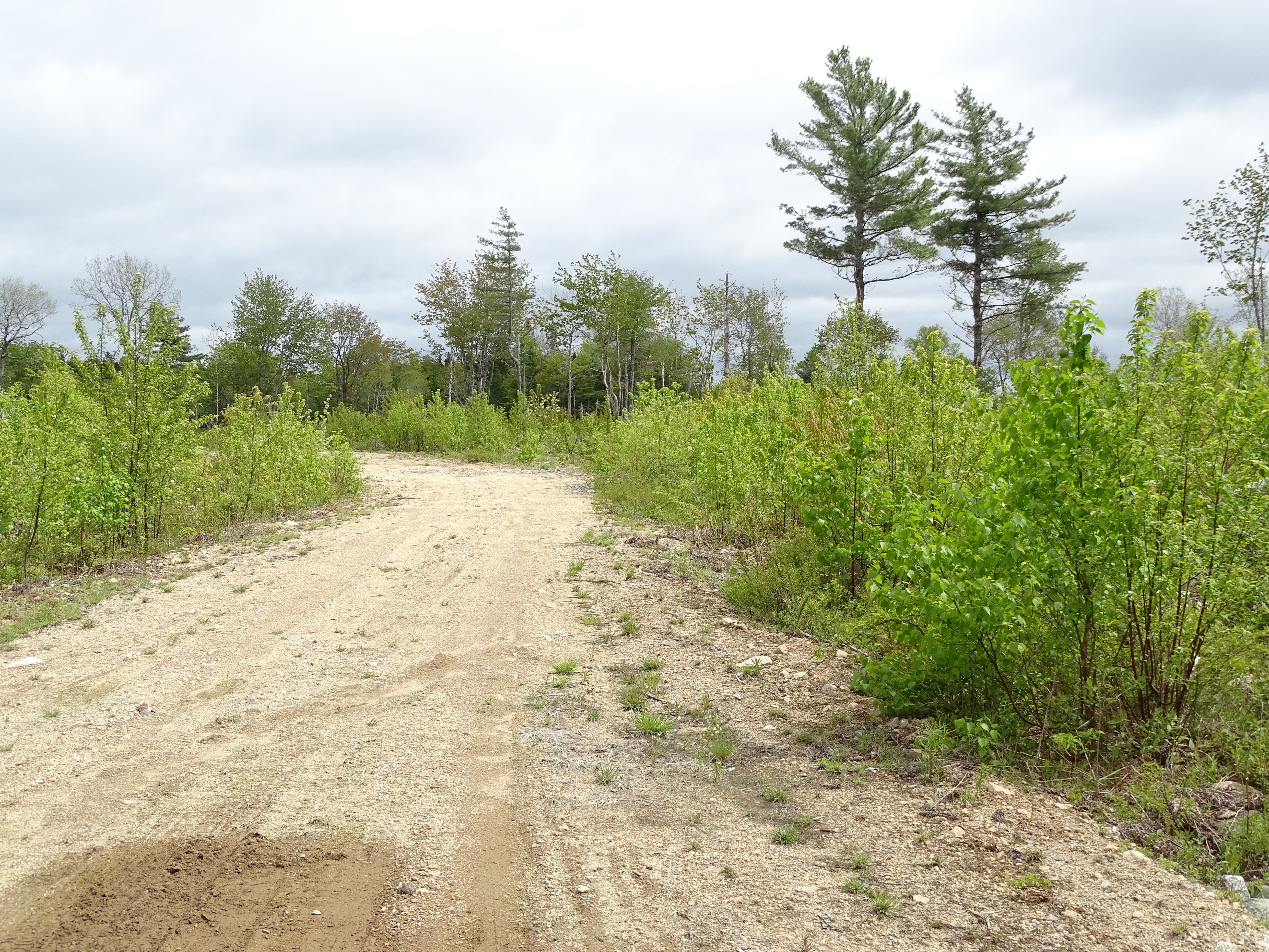
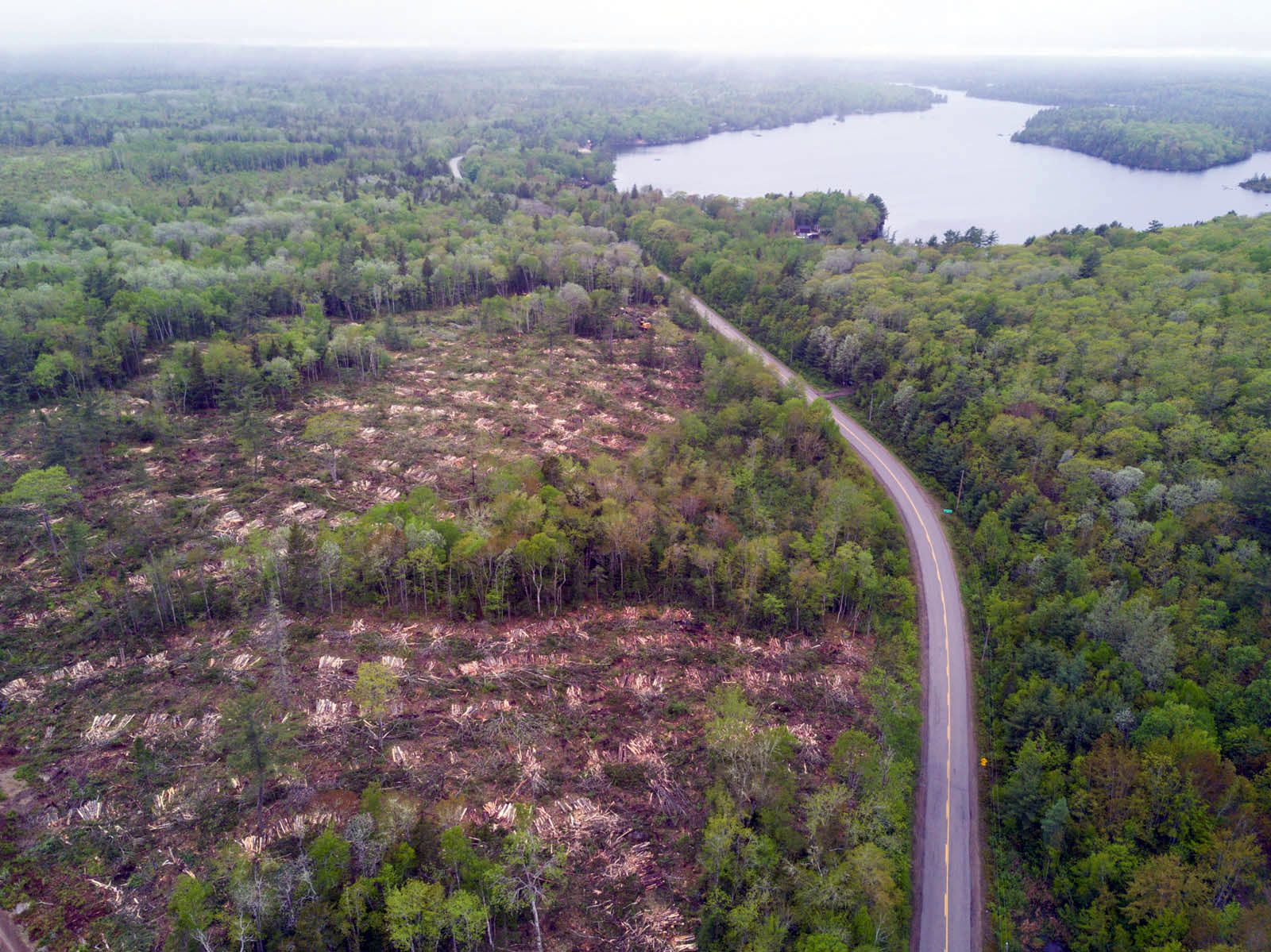
Picturesque Annapolis Co. 2017 (NSFN Photo)
Click on photos for larger versions
ANNAPOLIS CO
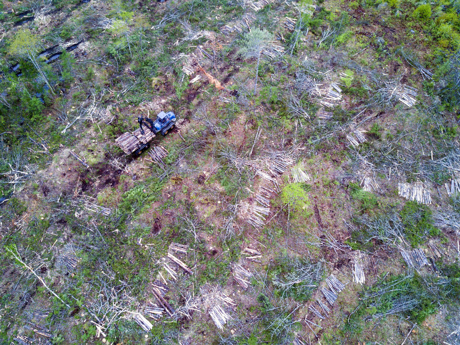
Between Annapolis Royal and Keji Park. Photos by Scott Leslie, June 2017. (For More info, view Scott Leslie’s clearcut photos on HFN website)
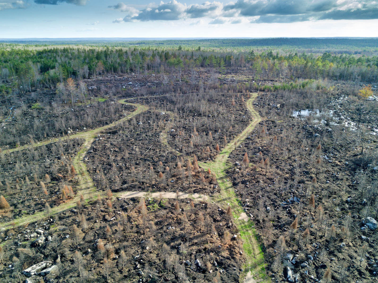
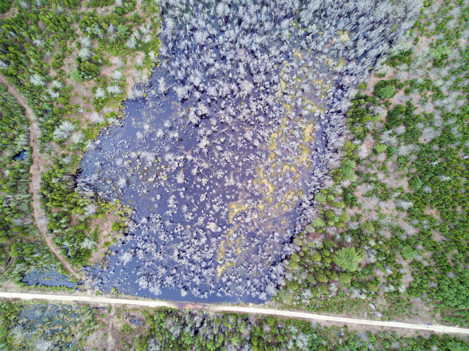
Above: Collatoral damage – culverts either not present or too small to allow rapid drainage resulted in death of trees by waterlogging.
For more on struggles to reduce logging in Annapolis Co, Search Annapolis
Also: Nova Scotia Old Growth Ground Zero
———
Comment from Bev Wigney:, June 4, 2021 (bolding inserted):
Hello Forestry Maps,
I see from today’s email that you no longer want people to submit comments via email. What should those of us do who have rural connections on which the HPMV site doesn’t work? I realize that you wouldn’t have such a problem with accessing the map and making the comment forms work because you have PROPER HIGH SPEED INTERNET in your offices, but for those of us who have been tolerating years of horrible internet service while awaiting the fabled coming of REAL INTERNET at some time in the unspecified distant future, the maps won’t even load on some of our computers. For me, it’s about 1/4 of the time. However, for some of the people in our county (Annapolis), especially those on the North Mountain, or in Dalhousie area, the maps won’t work at all, or if they load, the parcels don’t appear. So, how do you want THOSE OF US to submit their comments?
Also, if people have other comments to make — of a nature that you don’t actually wish to receive, which office should we now send them to? Is there anyone there who cares what the people in our area (Annapolis) think of the various parcels that are to be chopped down? It seems as though there is no one at DLF who wants to hear the thoughts and opinions of the taxpayers in this region, or who might like to have some input about what we think about harvest plans for the Crown land parcels in our area. For example, why should we not be able to comment that a parcel may be one of the only remaining areas for people to go for a walk near our towns when we have NO OTHER PLACES to go walking that aren’t on private property, or that haven’t already been chopped up as a clearcut so that they are impossible to crawl through?
Maybe you can come up with some solutions to these problems or suggest some person we can write to. Please do not suggest writing to our MLA or the Premier because they never reply and probably don’t care or even want to hear from us.
regards
Bev Wigney
Annapolis Royal, NS.
——
I wonder whatever happened to the Strategy for Improving Openness, Transparency, Collaboration and Accountability at the Department of Lands and Forestry (2019). From that document:
Overall, it is fair to characterize the communication environment between the Department and its stakeholders as being significantly strained. A cross-section of external stakeholders has identified a lack of trust in the department. One example that continuously surfaced in our research related to the online Harvest Map and the inability to obtain information with ease. Stakeholders also noted that approximately six months ago the language used to identify forestry practices on the map was changed in what they believed was an attempt to confuse or hide information. Internally, the map was seen as a positive step toward information sharing and the language change was meant to reflect terms that were actually used within the Department. The Harvest Map example is poignant in that it demonstrates that the while the intent was to make improvements, it had the opposite effect outside of the Department. Had stakeholders been engaged in the development of the map from the beginning, it could have been a more effective, and valued tool.
& from JR:
I noticed this change today too – seems like a move away from consultation/ gathering feedback to “just the facts”. However I suppose “information the department is unaware of” could include how much the community values the Crown land from a recreational or traditional uses point of view …
& from RB:
This decision is arbitrary and undemocratic. The tool they provide is inaccessible to many citizens who either: 1) cannot figure out how to use this tool, or 2) do not have reliable internet service capable of handling the complexity of the tool.
NS Forestry Maps is (intentionally or not) censoring the concerns of citizens by denying their voices and refusing to provide a reasonable and accessible avenue to express those concerns. It essentially censors people who wish to have their concerns heard and taken into account.
I, for one, have been tutored 3 times by 3 different individuals on how to use this Forestry Planner tool and could never get past step 1. I can only assume that the unreliable, rural internet service (the only internet service available to me) is not capable of handling the complexity of the tool provided.
This is unacceptable and unethical in a democracy where citizens have the right to express their concerns.