I appreciate the quick response of L&F to my inquiry about license renewals. I have to wonder, though, why such info is not routinely made available on the web page for the Forest Harvest Allocation Maps – along with the landscape maps showing where harvests are planned (or proposed) over the periods covered by the agreements.

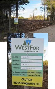
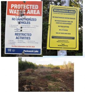
The WestFor license includes some lands in the Pockwock Watershed which has created a bit of stir on Social Media recently, re: a post on Woods and Waters Nova Scotia
On Sep 30, 2019, I wrote the media contact L&F with this request:
Subject: License renewals for WestFor, Northern Pulp, GNTI
Can you give me any info on these renewals? When are they effective, for how long?
Any other details as can be made available to the public, e.g. the actual agreements.
Thanks
She replied promptly that she would look into it and got back to me today (Oct 8, 2019) with this response:
As we did last year, we have renewed the timber license for Northern Pulp (attached) for a 12-month period until July 31, 2020.
As we did last year, we have renewed the timber license for Westfor (attached) for a 12-month period until September 30, 2020.
Please note the volume table that accompanies this agreement is the total for the current agreement (Oct 1, 2017 to Sept 30, 2020), and is not the total for the one year extension.
GNTI had an amendment to their Timber License in August 2019 (attached) which increased the volume from 38,000 GMT to 49,000 GMT’s. This includes a requirement for sawable hardwood to go to the Groupe Savoie hardwood sawmill in Westville. Their license is in effect until December 31, 2019.
and attached the license agreements:
Amending Agreement – NP Timber License – Aug 2019
I appreciate the quick response of L&F to my inquiry. I have to wonder, though, why such info is not routinely made available on the web page for the Forest Harvest Allocation Maps – along with the landscape maps showing where harvests are planned (or proposed) over the period covered by the agreements.
Such maps do, apparently, exist. At a recent workshop on the Forest Management Guide, I was told by a ‘knowledgable individual’ that the harvest proposals we see on the Map Viewer are planned more than two years ahead within L&F. A map of this nature showed up, fleetingly, in Shelburne early this year.
So it seems our government has the maps, prepared in collaboration with the forest industry who also have the maps. Why, then, is even the fact of their existence kept hidden from the major stakeholder in the Crown lands – the public?
Related Posts:
–
Oct 7, 2019Concerns about clearcuts in Pockwock Watershed
On Woods and Waters Nova Scotia (Facebook Page) Oct 6, 2019
– WestFor license up soon & “Urgent Action: 5 Days to Save A Forest – Nova Scotia” 27Sep2019
NSFN Sep 27, 2019
– FYI: Nova Scotia L&F/WestFor Agreement FOIPOPed
NSFN December 29, 2018

