
With these latest additions, the total area protected is 12.4% of Nova Scotia’s land area.
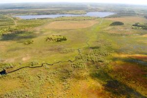
Chignecto Isthmus Wilderness Area (PPA photo)
The largest was an expansion of the Chignecto Wilderness Area (designated 2008). “This wetland and forested addition to Chignecto Isthmus Wilderness Area, near Nova Scotia’s border with New Brunswick, nearly quadruples the size of the existing wilderness area to over 3,700 hectares…Chignecto Isthmus is a critical land bridge that links Nova Scotia to New Brunswick and the rest of North America.” In addition, “The Nature Conservancy of Canada has protected an additional 3,000 acres nearby, along the Nova Scotia/New Brunswick border, as part of an ongoing effort to secure a permanent wilderness corridor for wildlife, including Nova Scotia’s mainland moose.” (Amherst News, Mar 23, 2017)
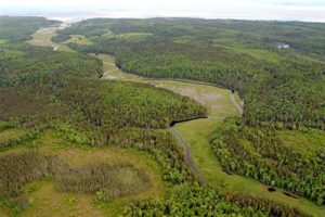
Walton River Wilderness Area (PPA photo)
The newly designated Carleton River Wilderness Area (919 ha) “consists of two parcels, about 1.5 km apart, along the east side of Carleton River, near the community of Forest Glen, in the interior of Yarmouth County. The wilderness area lies within the Tusket Drumlins natural landscape, a biologically rich part of southwestern Nova Scotia, with gently sloping hardwood and mixedwood hills, and numerous lakes. Stands of mature sugar and red maple, yellow birch and beech blanket the rolling terrain, with red spruce through the intervening, flatter lands.”
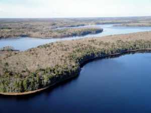
Carleton River Wilderness Area (PPA photo)
Under EGSPA (the Environmental Goals and Sustainable Prosperity Act, passed in 2007) Nova Scotia committed to protect at least 12 per cent of its land area by 2015. By the end of 201512.26% was protected,
With these new designations the area protected is now about 12.39%. View Designation Types to see what is included.
View a map of the March 2017 Designations
View a table of newly designated areas
View Interactive Maps of Parks and Protected Areas
Congratulations and Thanks, NSE/Parks and Protected Areas!