
Maps of AP068499 Beals Meadow & Environs available in the public domain
These maps were prepared in Jan & Feb of 2022
List
– Crown, Protected and Private lands Go
– Recent Google Earth Map Go
– Closer up in the area of Beals Meadow:
Google Earth Images 2006-2010-2018 Go
– Global Forest Watch Map showing changes
in forest canopy cover 2001-2020 Go
– Forest Development Class Go
– Planned Harvests March 2016 superimposed
on Forest Development Class Go
– Closer up in the area of Beals Meadow:
Leading Forest Species Go
– Closer up in the area of Beals Meadow: Forest Stand and Forest Treatment Details Go
– Wetlands
– WAM Wetness Index Go
– Closer up in the area of
Beals Meadow: WAM PREDICTED FLOWS Go
SOILS & GEOLOGY
– Area of Low Base Saturation Go
– Soils of NS Map Go
– Forest Ecosystem Classification Soil Type Go
– Geological map of Nova Scotia Go
– Geological (bedrock) map in area
of AP068499 Beals Meadow Go
– Surfical Geology. Go
– Toppography & Lidar closer up Go
– Southern Upland: Major Watershed pH Go
Forest Land Capability Go
Click on images for larger versions
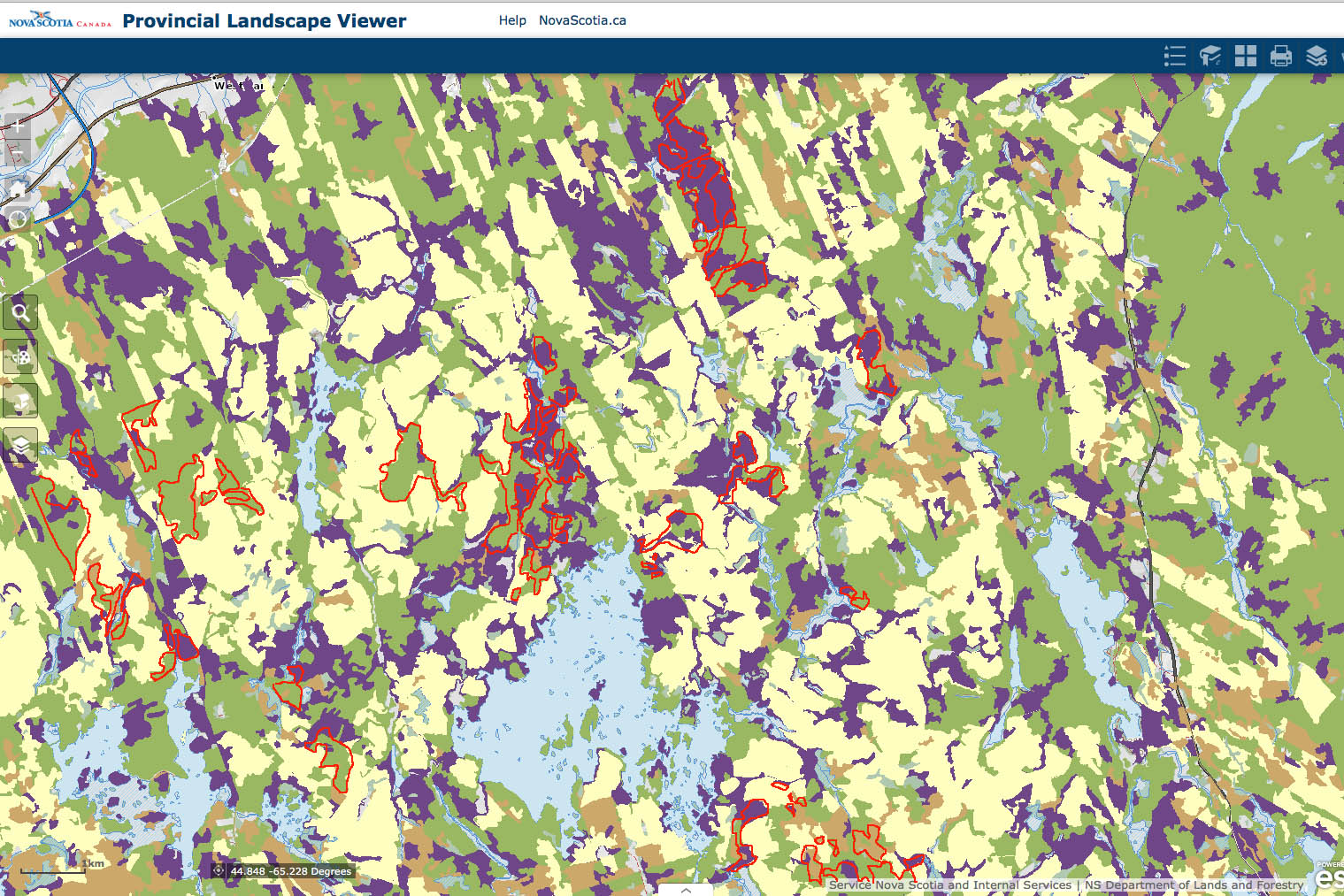
Crown, Protected and Private lands
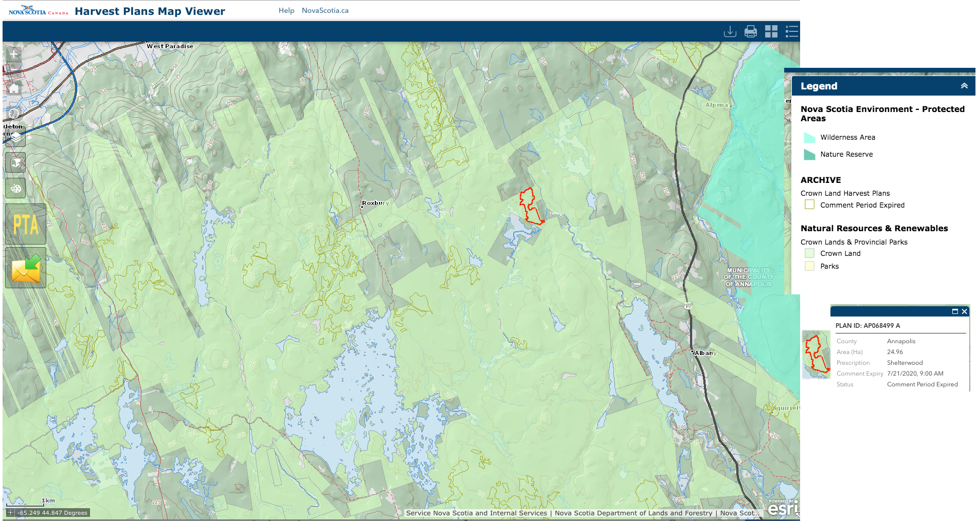
From the Harvest Plan Map Viewer 19Jan2022. The map shows the area of Crown land, and harvests approved since March 2016. The red-highlighted area is AP068499 Beals Meadow
Recent Google Earth Map
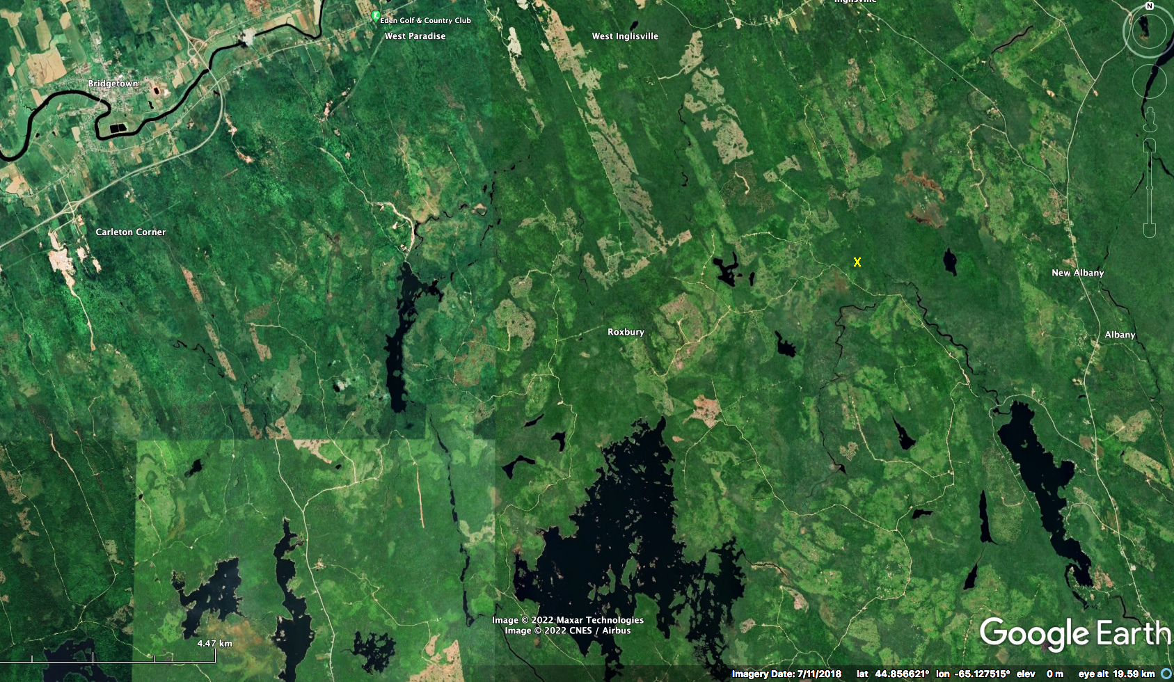
Google Earth Map for July 11, 2018. X is in the area of AP068499 Beals Meadow.
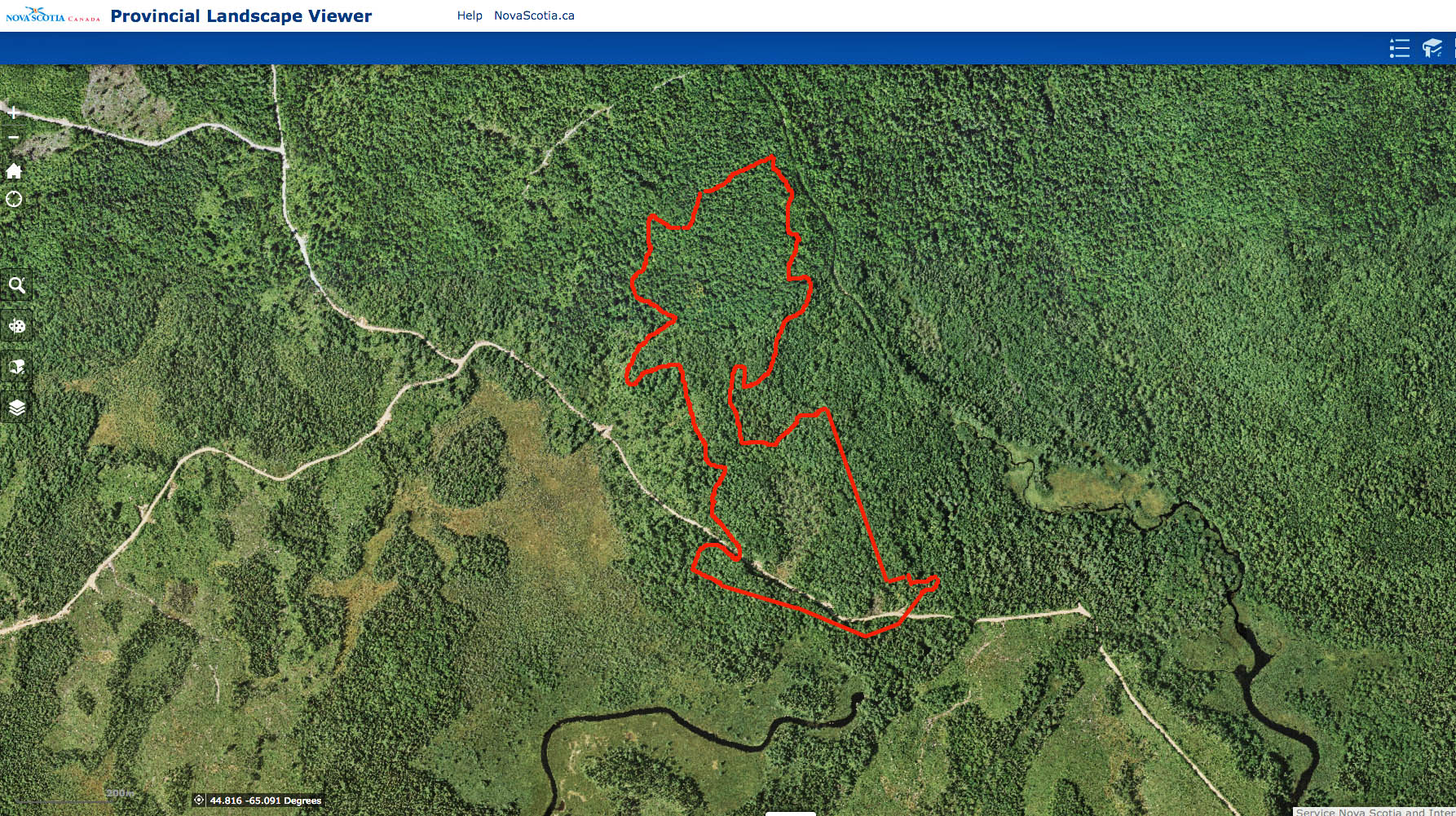
Closer up, from Nova Scotia Landscape Map Viewer Basemap Image
Closer up in the area of Beals Meadow: Google Earth Images 2006-2010-2018
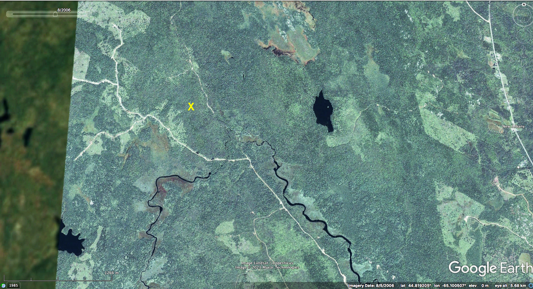
Google Earth Image Aug 5, 2006. X is in the area of AP068499 Beals Meadow.
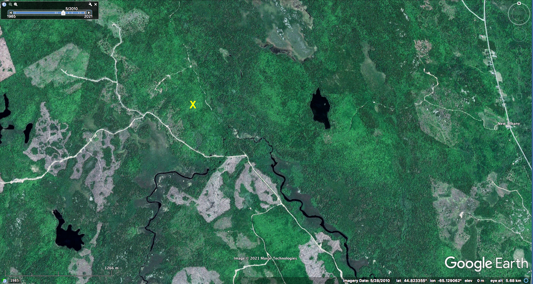
Google Earth Image May 28, 2010. X is in the area of AP068499 Beals Meadow.
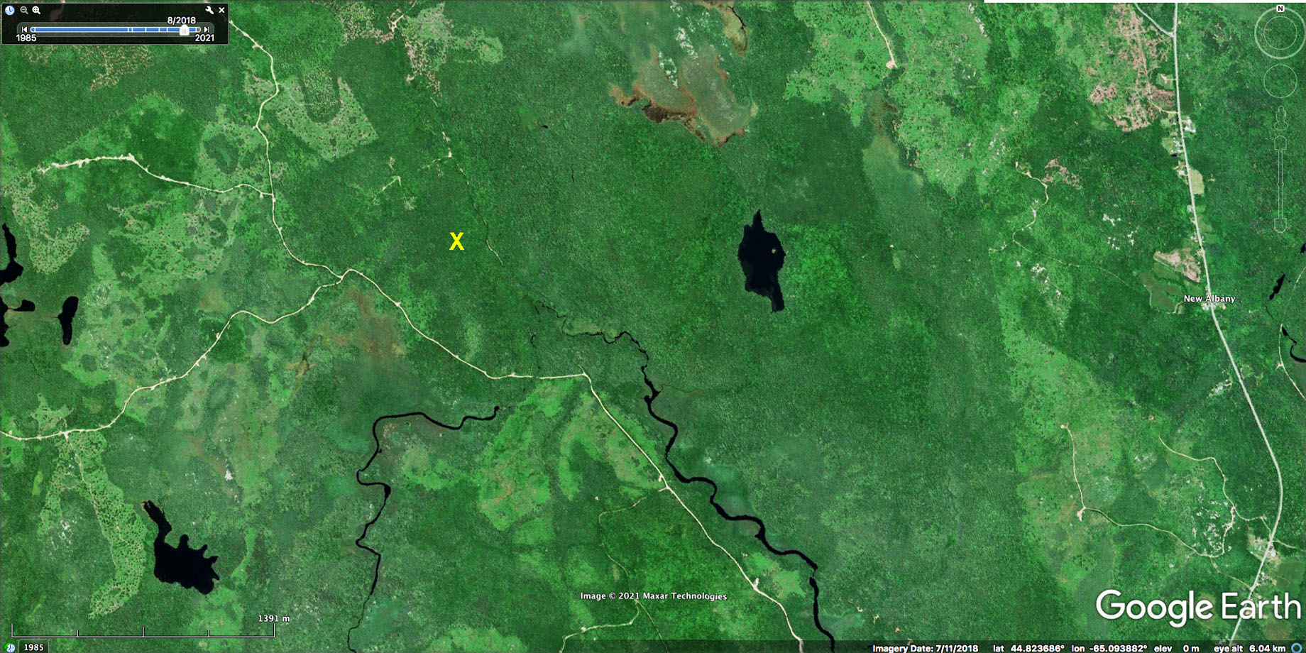
Google Earth Image July 11, 2018. X is in the area of AP068499 Beals Meadow.
Global Forest Watch Map showing changes in forest canopy cover 2001-2020
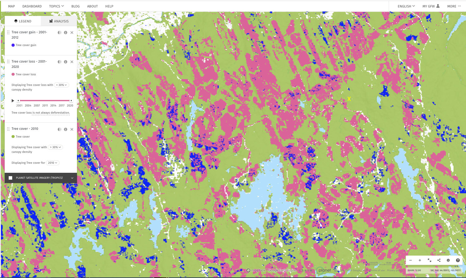
From Global Forest Watch. X is in the area of AP068499 Beals Meadow. View Time Sequence
Forest Development Class
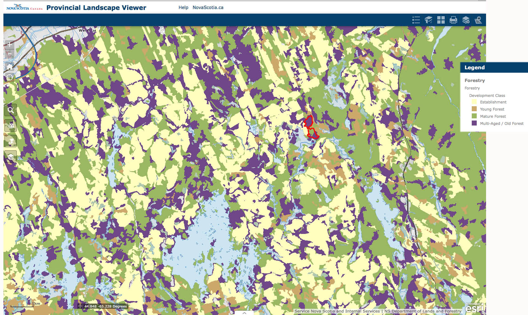
Forest Development Class, a layer on the Nova Scotia Landscape Map Viewer (PLV)
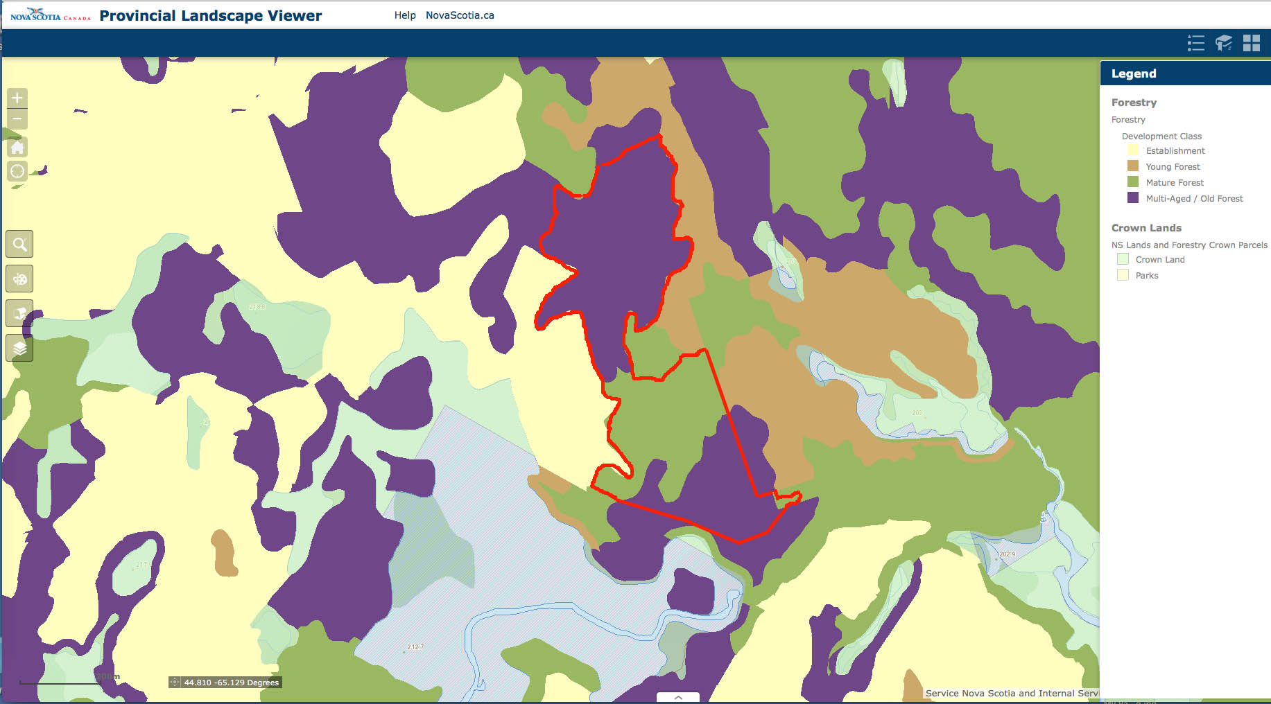
Forest Development Class, closer-up.
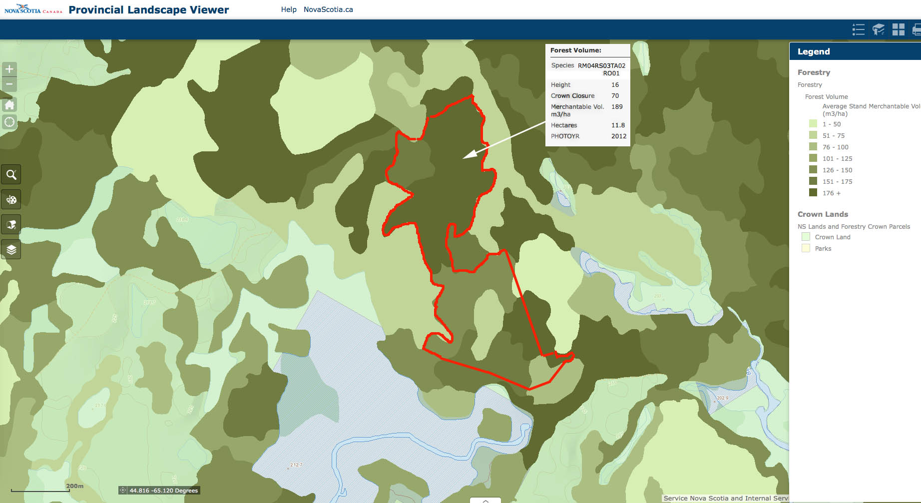
Volumes (Closer up)
Closer up in the area of Beals Meadow: Leading Forest Species
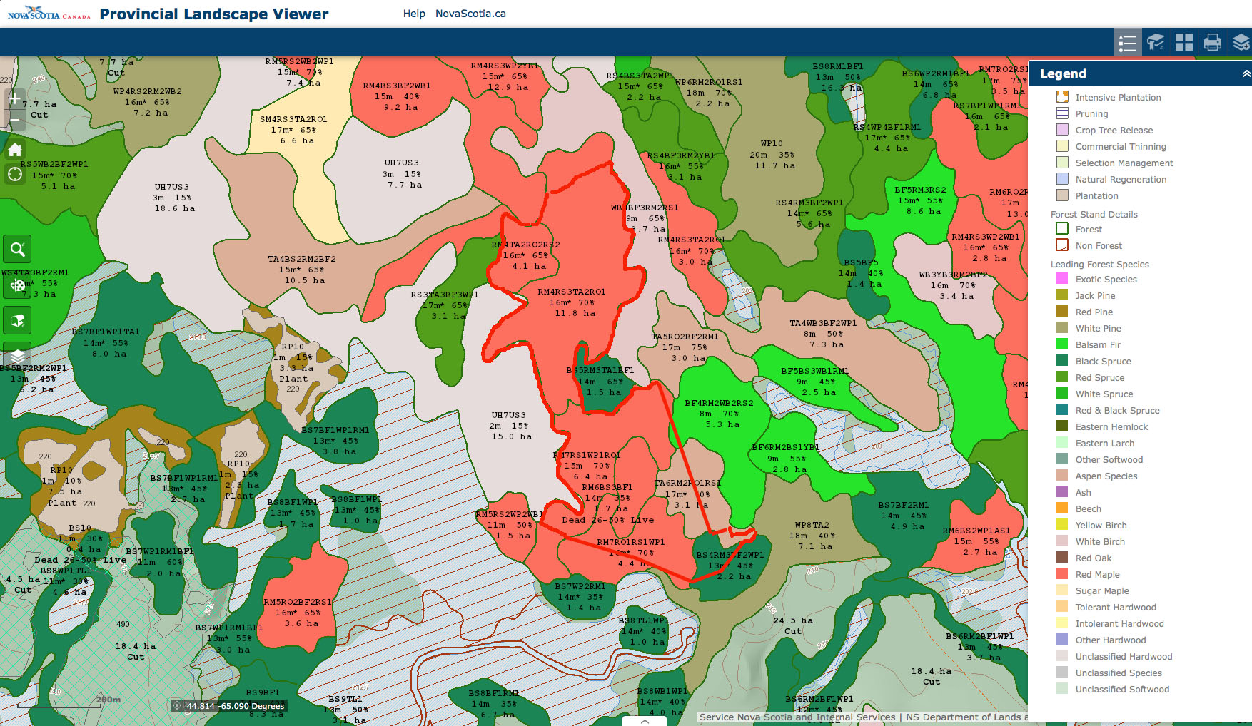
Leading Forest Species, a layer on the Nova Scotia Landscape Map Viewer (PLV). Area enclosed by red margin is AP068499 Beals Meadow.
Closer up in the area of Beals Meadow: Forest Stand and Forest Treatment Details
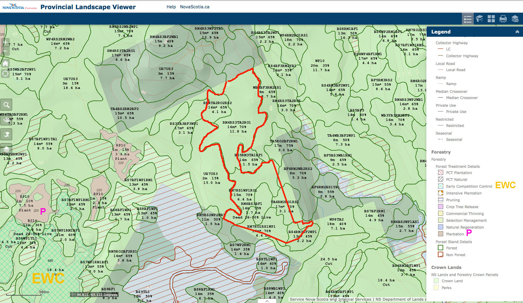
From a layer on the Nova Scotia Landscape Map Viewer (PLV). Area enclosed by red margin is AP068499 Beals Meadow. EWC is Early Competition Control; Treatments were in 2014. Owner: Crown, P is Plantation; these treatments were all in 2005. Owner is described as Private(these lands were purchased by NS Government in 2012.
Planned Harvests March 2016 superimposed on Forest Development Class
Wetlands
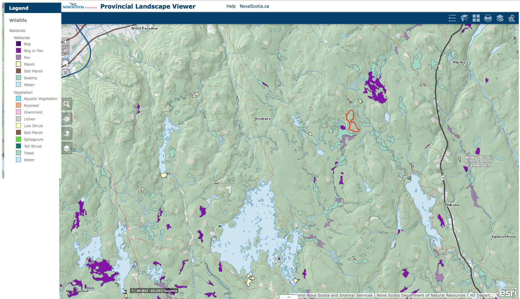
Wetlands, a layer on the Nova Scotia Landscape Map Viewer (PLV)
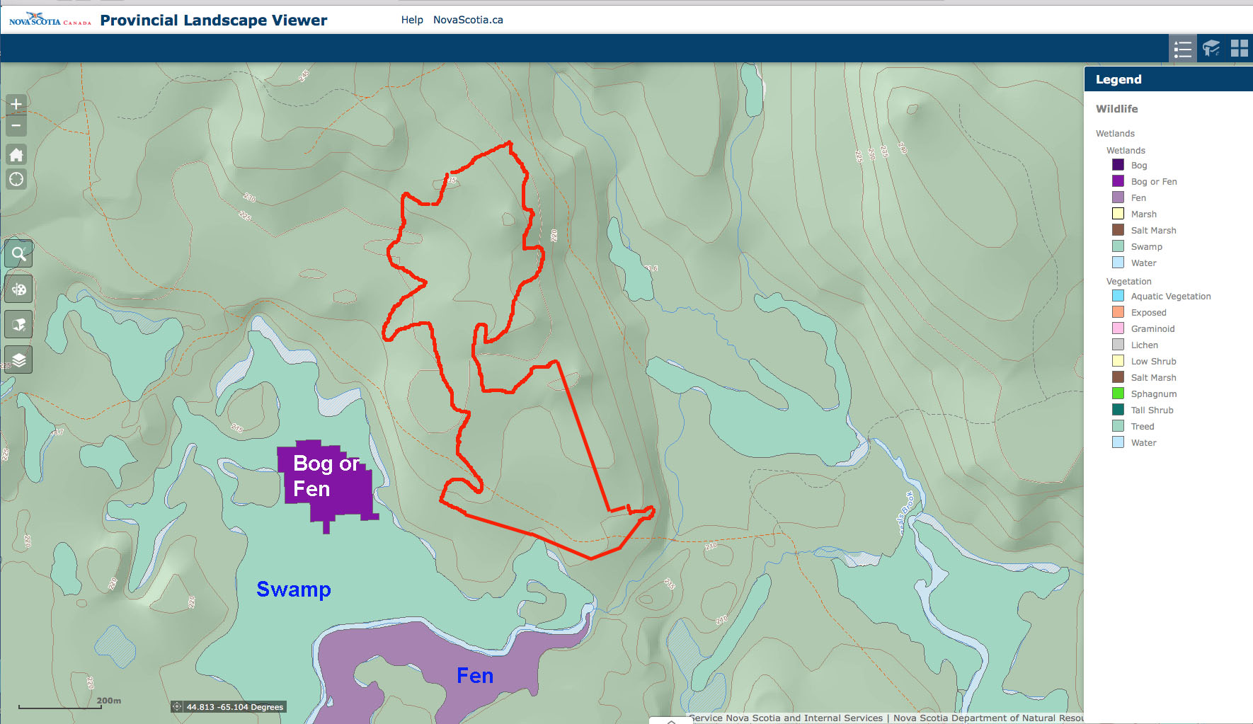
Closer up in the area of Beals Meadow: Wetlands . A layer on the Nova Scotia Landscape Map Viewer. Area enclosed by red margin is AP068499 Beals Meadow.
WAM Wetness Index
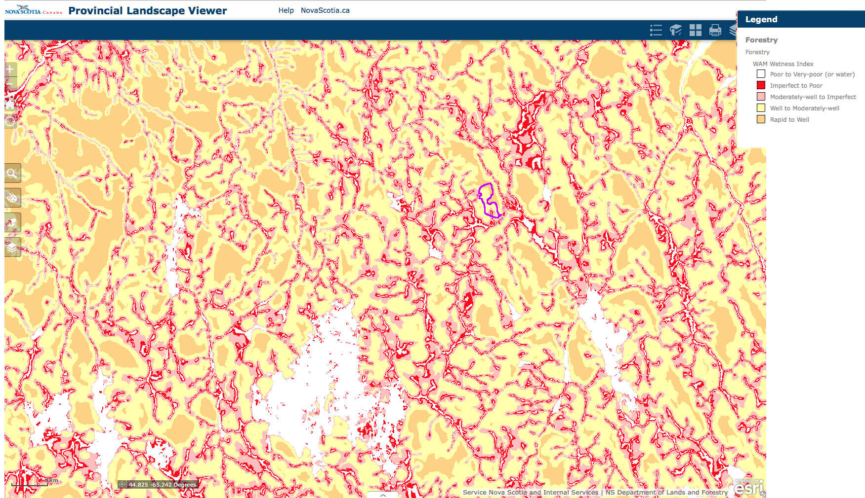
WAM Wetness Index, a layer on the Nova Scotia Landscape Map Viewer (PLV)
Closer up in the area of Beals Meadow: WAM PREDICTED FLOWS
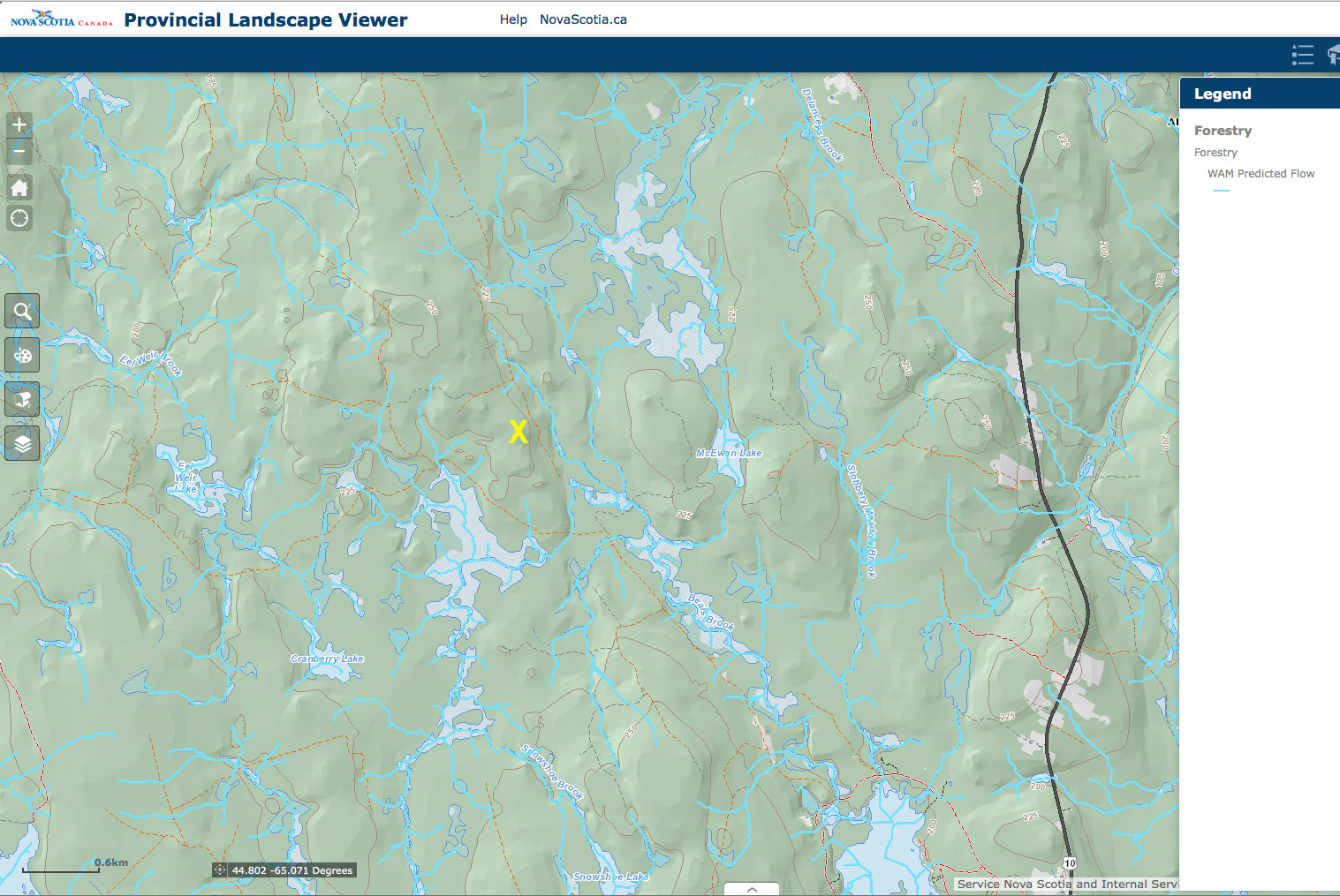
WAM Predicted Flows, a layer on the Nova Scotia Landscape Map Viewer (PLV) Yellow X is in the area of Beals Meadow
Area of Low Base Saturation
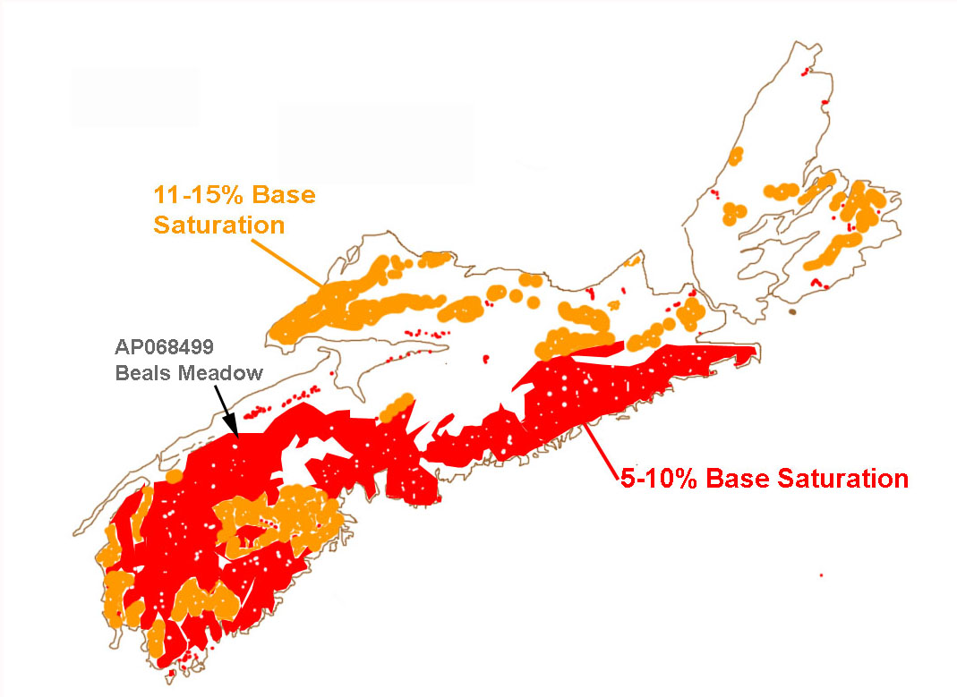
Sketch after Fig 3. in Keys et al., 2016.
Soils of NS Map
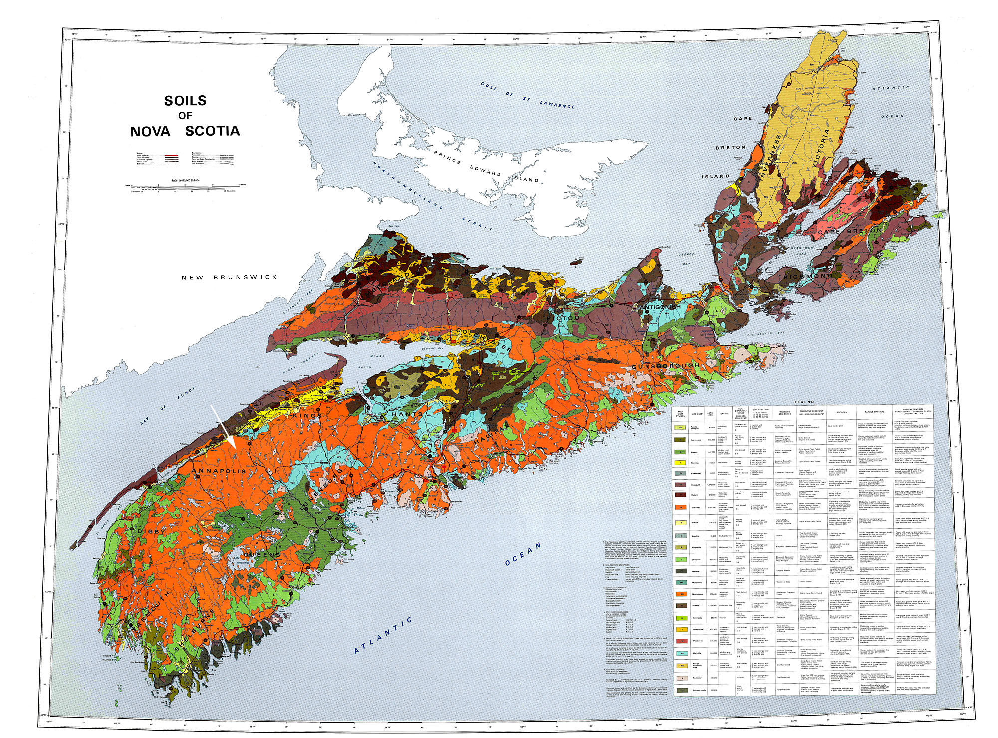
Soils of NS Map (1972) Low res. version. Legend below. View original Legend for the area of AP068499 Beals Meadow below.
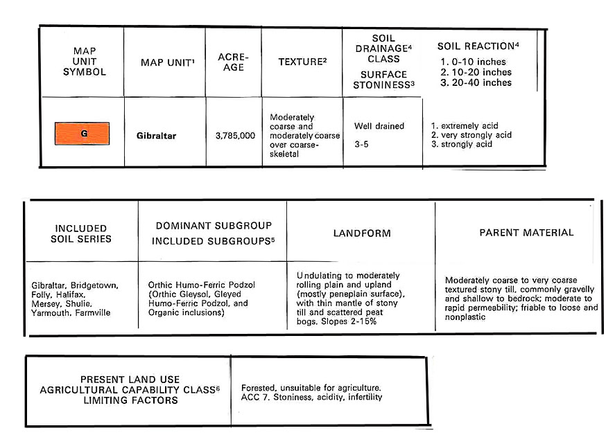
Soils Map Legend for Gibraltar soil series
For more detail, see Soil Survey of Annapolis County
Forest Ecosystem Classification Soil Type
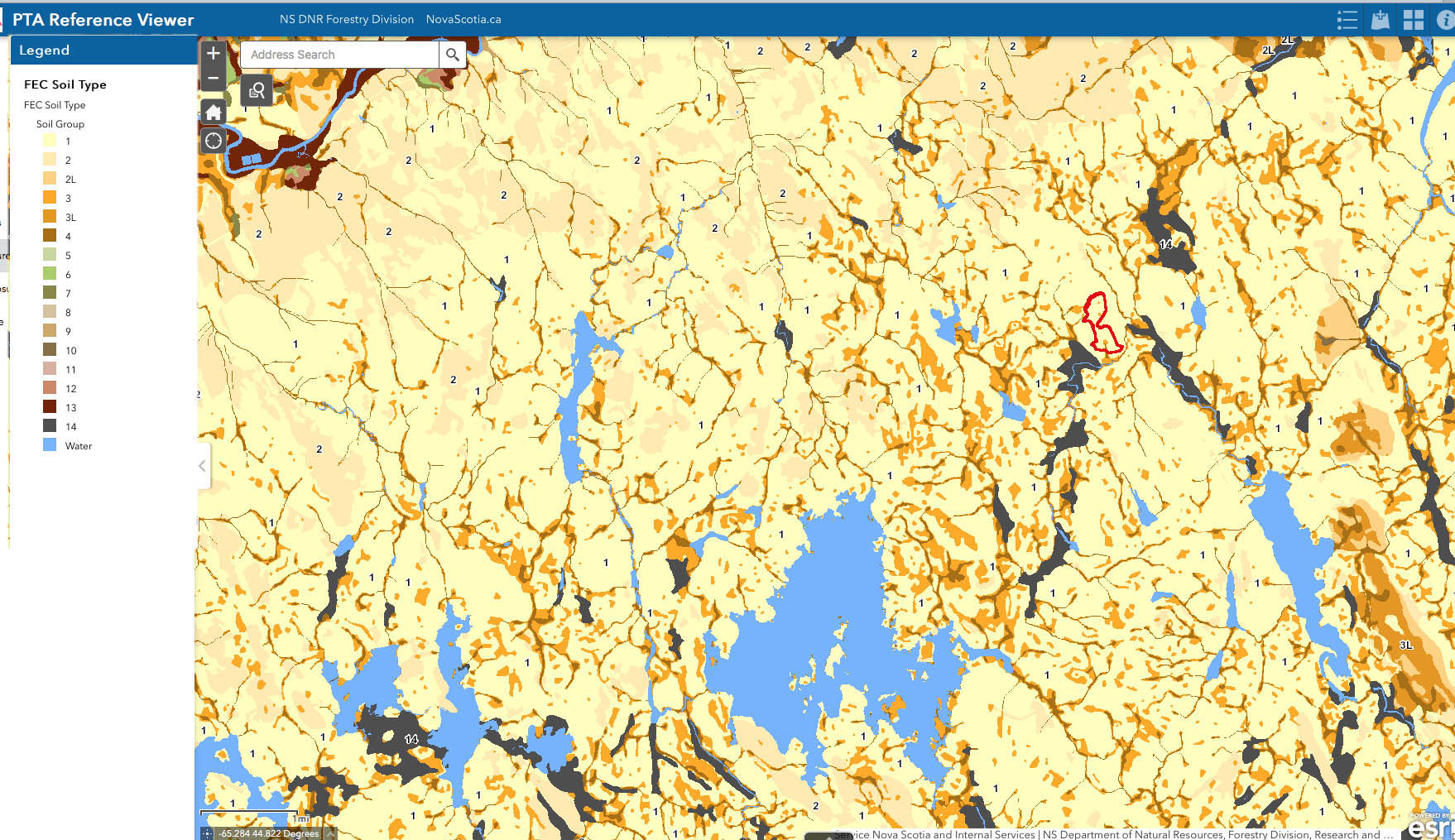
FEC Soil Type CLOSEUP/ From Pre-Treatment Assessment Reference Viewer
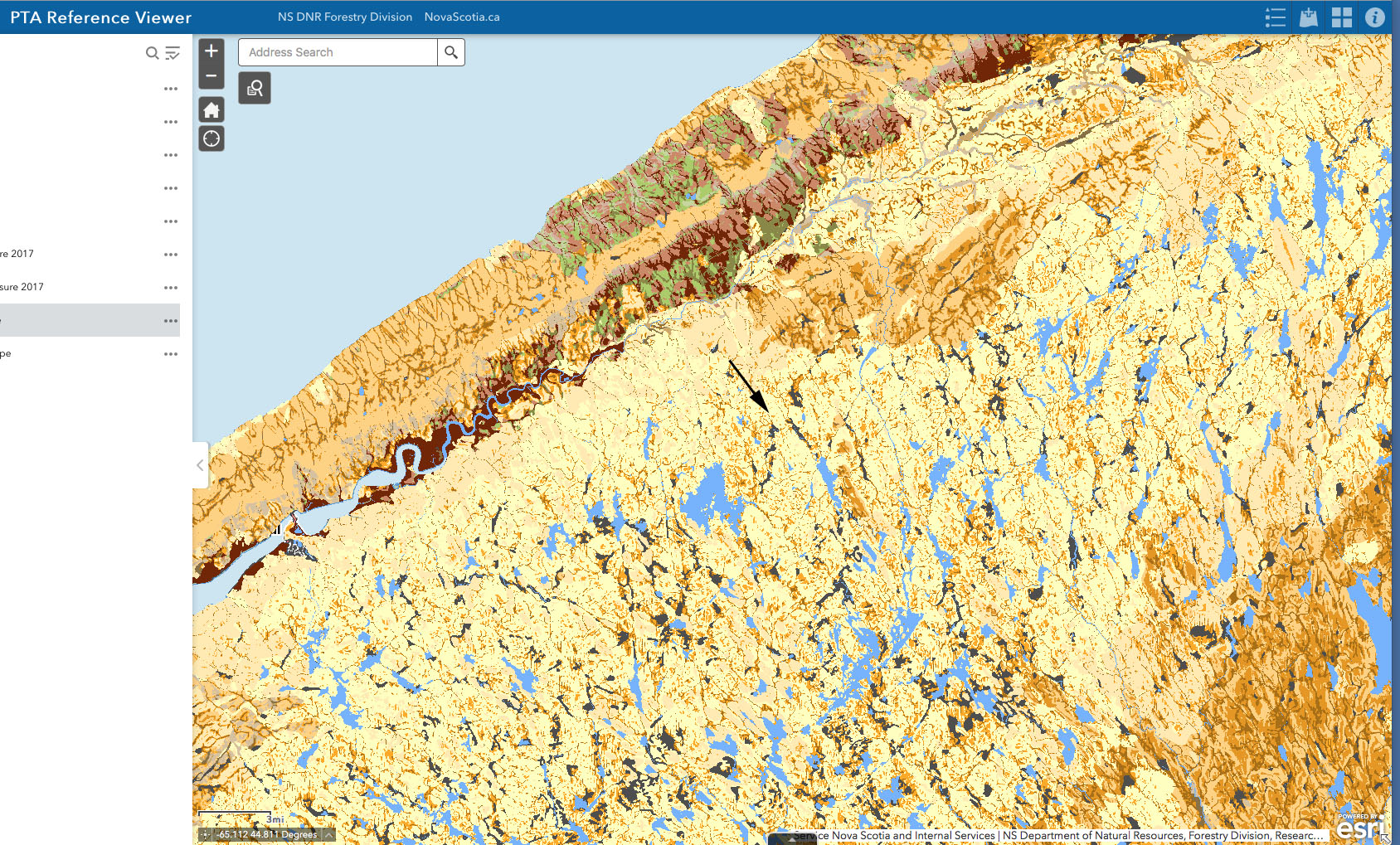
FEC Soil type, Broader area
Related Documents:
– Forest Soil Types of Nova Scotia Identification, Description, and Interpretation
Kevin Keys et al., 2007. NSDNR
– Forest Ecosystem Classication for Nova Scotia Part II: Soil Types
Kevin Keys et al., 2010-11. NSDNR
Geological map of Nova Scotia
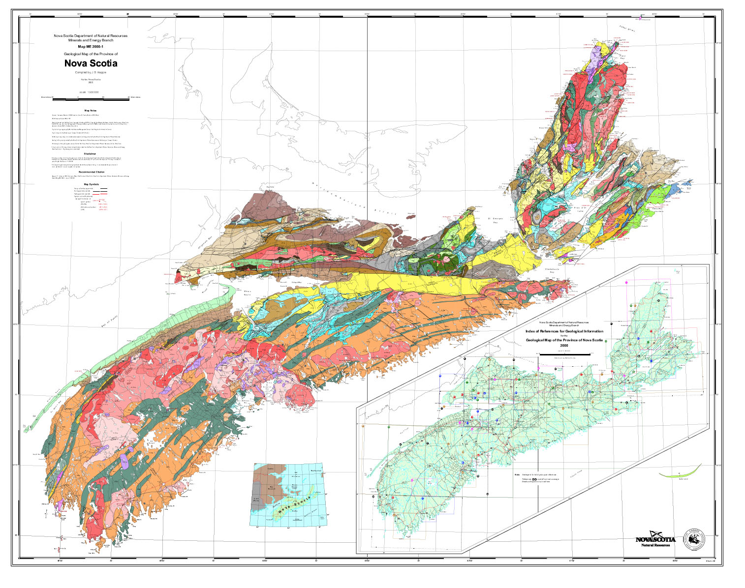
Geology of NS (low res screen capture). A print doc, 2000-1 Source
Geological (bedrock) map in area of AP068499 Beals Meadow
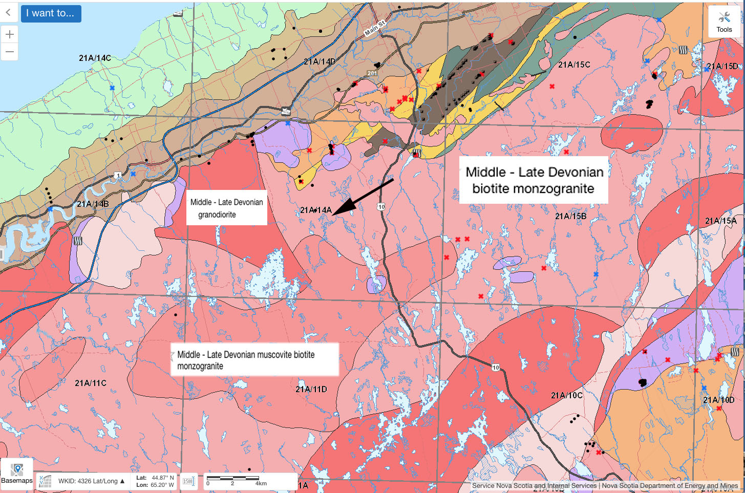
Closer up. From Interactive Geology Map. X is in the area of AP068499 Beals Meadow.
Surfical geology
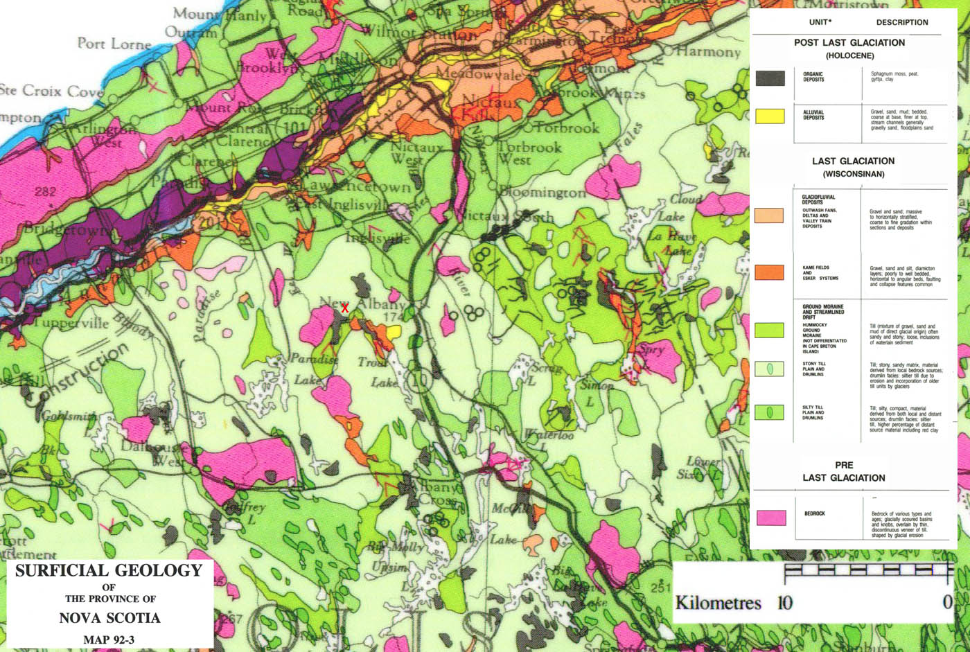
Surficial Geology, from 1992 Map Red “X” northeast of Paradise Lake is location of AP068499 Beals Meadow
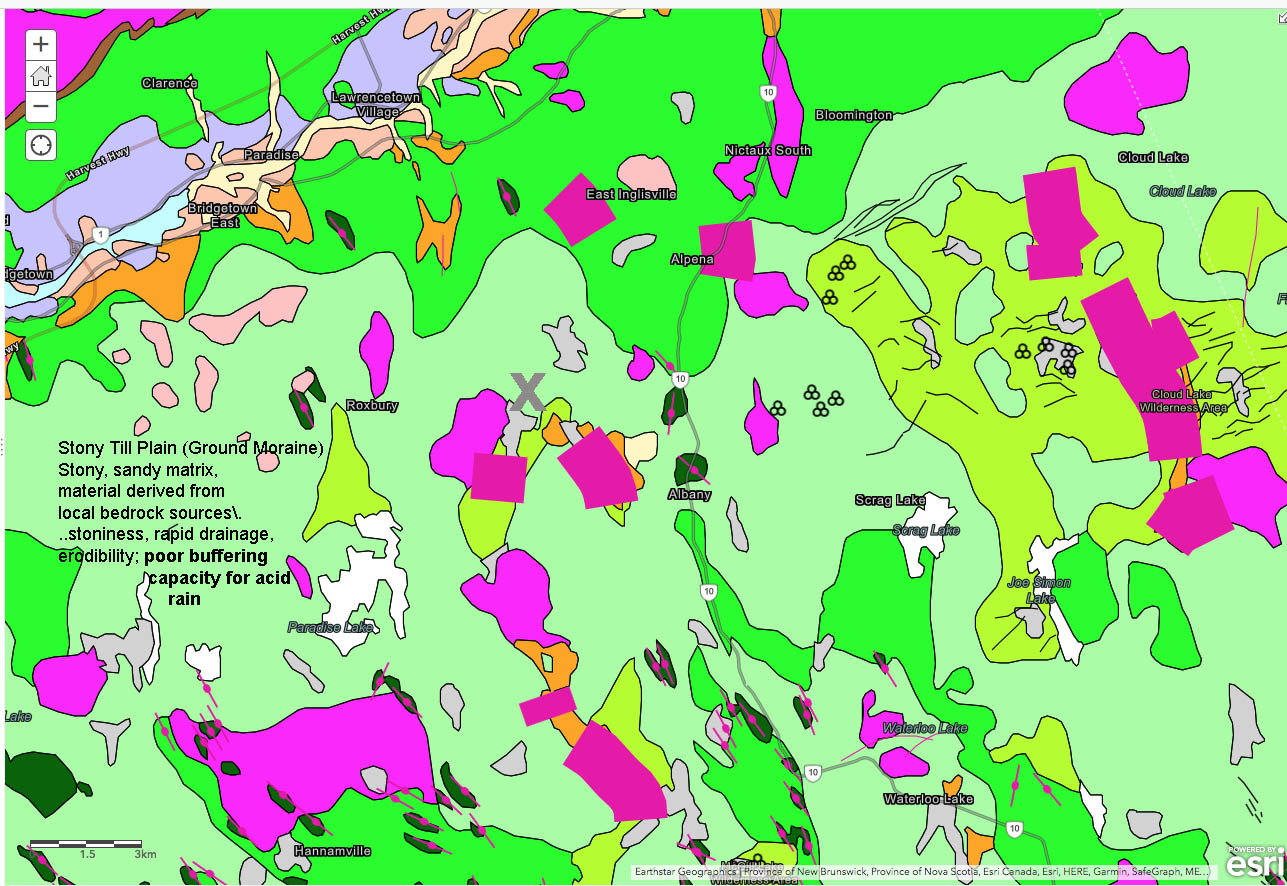
Surgical geology from ArcGIS Surficial Geology Map of Nova Scotia. “X” northeast of Paradise Lake is location of AP068499 Beals Meadow. Stony Till Plain description describes pale green area.
Topography and Lidar
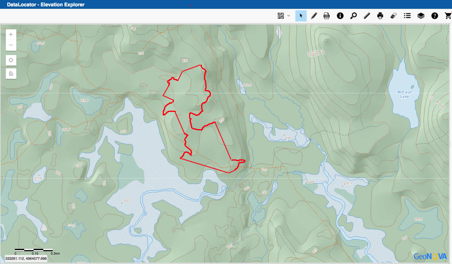
Topography, from NS DataLocator – Elevation Explorer
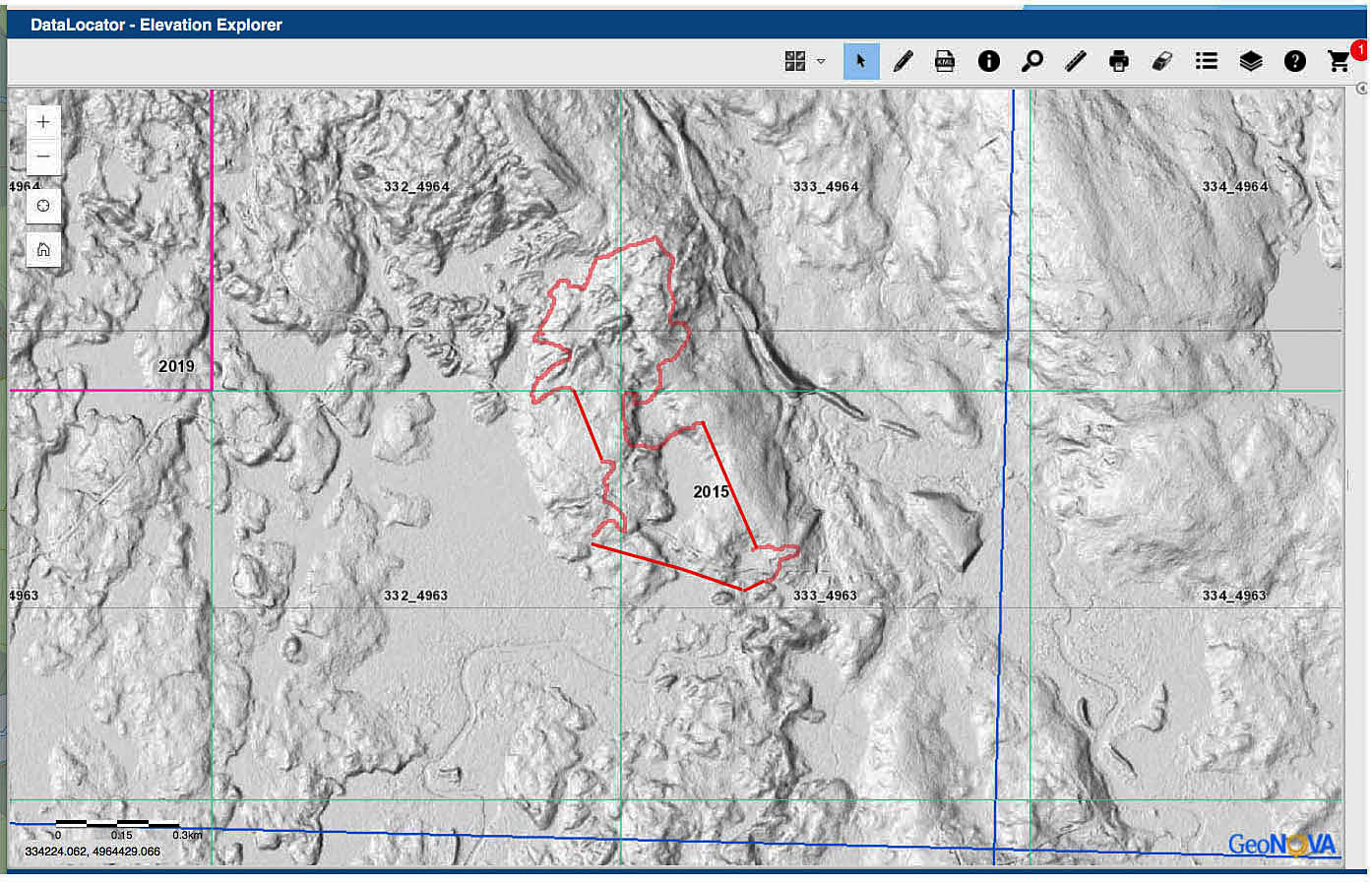
Lidar, from NS DataLocator – Elevation Explorer
Southern Upland: Major Watershed pH (acidity)
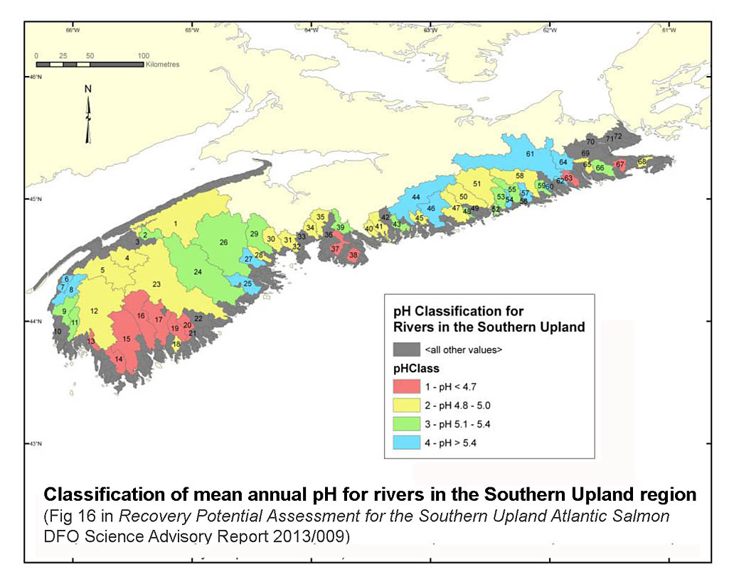
From RECOVERY POTENTIAL ASSESSMENT FOR SOUTHERNUPLAND ATLANTIC SALMON, DFO Science Advisory Report 2013/009. Watershed 1 is Annapolis/Nictaux
“In Nova Scotia, acid precipitation affects slightly less than half of the total landmass, due to a divide of geologic characteristics. A lithological formation known as the Southern Upland lies south of a line drawn between Digby, Digby county and Canso, Guysborough county (Figure 1.3, p.27). It is compromised of hard igneous and metamorphic rocks, primarily slates, granites and greywacke, which are slow to degrade and provide few base cations. This area is generally low gradient with altitudes rarely exceeding 140m and is dominated by peat bogs and coniferous forests, which have high rates of release of organic acids. Because of these features, the area is naturally slightly acidic, contains little alkalinity and does not have the ability to buffer the large additions of acid experienced with acid precipitation.” -from Halfyard, 2008
Forest Land Capability
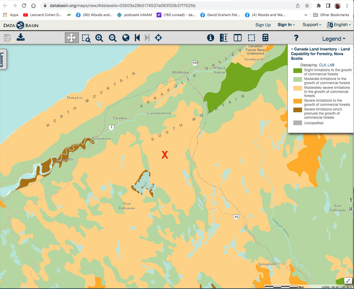
From Canada Land Inventory accessed May 6, 2022