
With Cliff Seruntine aboard the Microsoft Flight Simulator flying a route from Liverpool to Digby in 2020
Click on images for larger versions
Outdoors person, educator and naturalist Cliff Seruntine has produced an innovative virtual flyover on a route from a rural airport inland from Liverpool to just to the north of Kejimkujik National Park (KNP) and on to Digby with some diversions north and south to illustrate the extensive clearcutting getting ever closer to KNP.
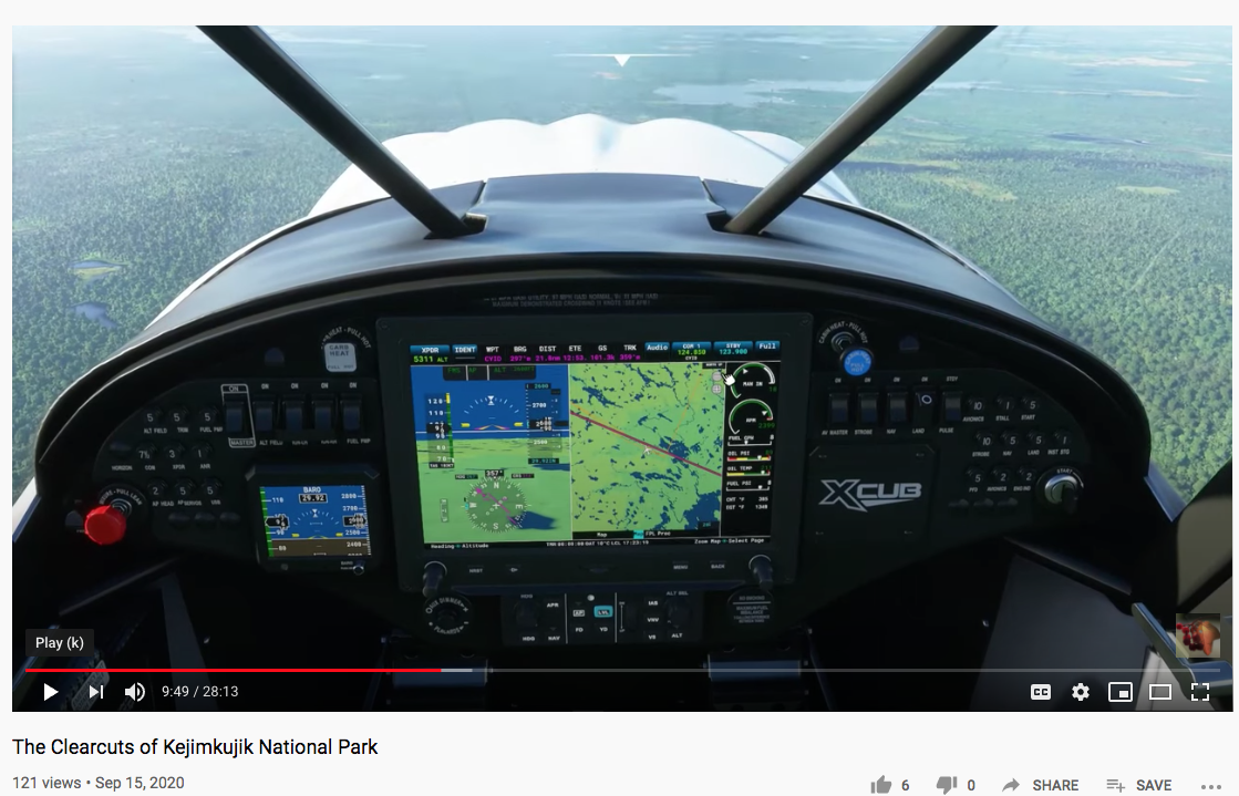
Cliff S. has produced many videos of his on-the-ground excursions, often with overviews obtained with drones. I believe this is his first use of the Microsoft Flight Simulator 2020, and it’s impressive.
Says Cliff S., the simulator “creates photorealism by using actual satellite imagery of the entire planet… the data is dated 2020, so it’s very recent. What you are going to see in this virtual flight is what’s actually there.”
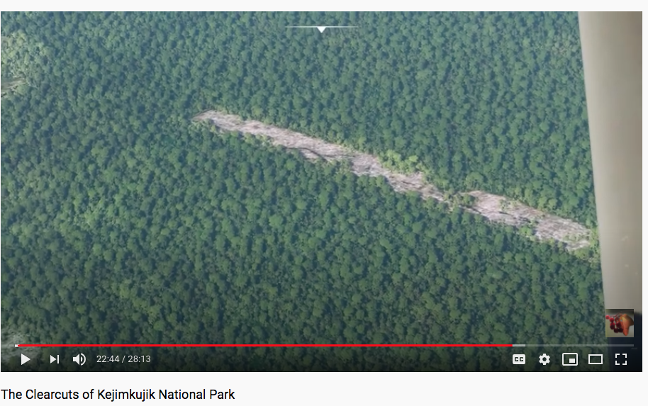
View The Clearcuts of Kejimkujik National Park
By Cliff Seruntine, posted on YouTube Sep 15, 2020.
The 25 minute flight covers 85 km “as the crow flies”, but there are some diversions north and south of the flight path. Cliff S. describes and comments on what we see along the way. A few excerpts follow.
Early on, Cliff S. notes the proximity of some clearcuts to lakes; he comments that northern lakes are “not designed by nature to absorb all of that erosion; the erosion provides nutrients; giving too much nutrition to northern lakes leads to dangerous algal blooms.”
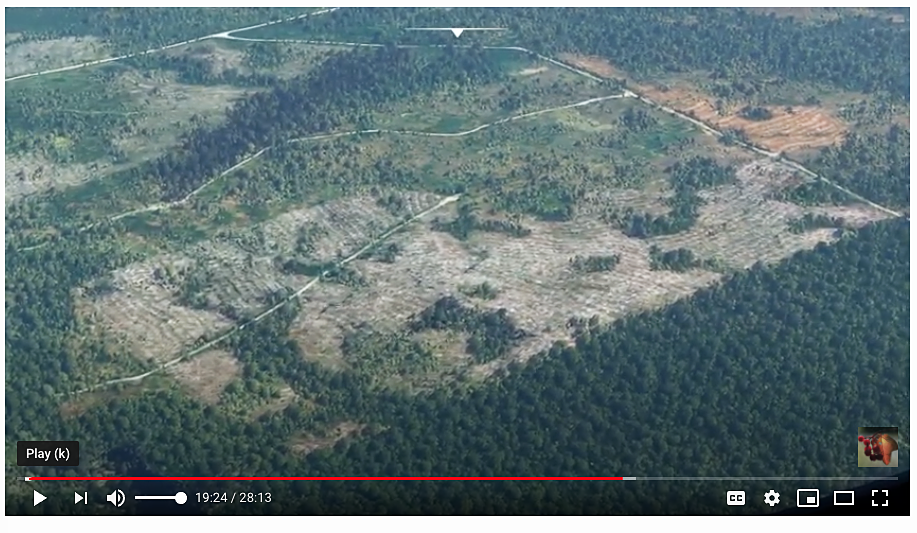
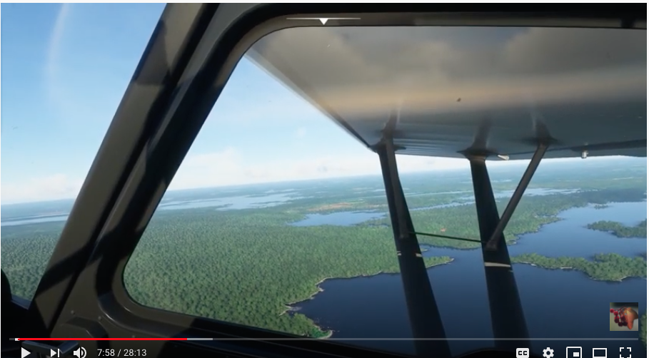 “South and west as we get closer to the environs of Kejimkujik National Park (KNP), we start to see more pristine land.. the view before us is unscarred by the massive patchwork work of clearcuts… let’s bank left and take a closer look…”
“In my experience, the KNP itself is kept pristine, but that is not going to do it much good if the surrounding forest which provides essential habitat to all of the wildlife in the area… as well as providing invaluable soil retention service, is allowed to be cut.”
“… we are getting to the edge of the wild area now and off in the distance we can see breaks in the landscape that indicate the presence of farms, human habitations and the distant pale patches that often reveal the activities of forestry. Notice those two lakes off the starboard wing how murky they are. In northern lakes this frequently occurs because they are receiving an overabundance of soil through erosion. Unchecked this will kill those lakes…”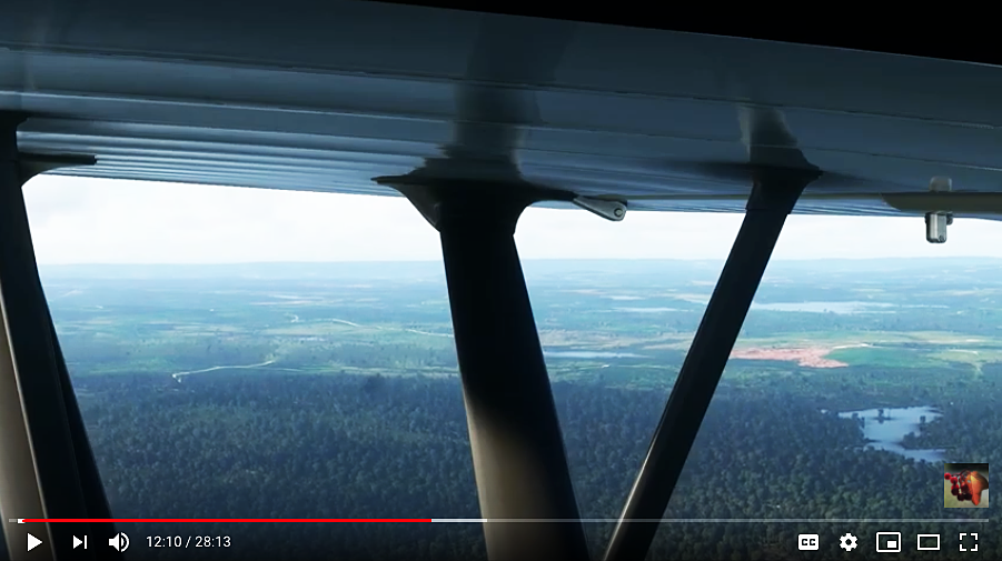
“I will take us a bit north of the confines of the park… Down below is a lovely expanse of undisturbed forest… but if we look a couple of miles off the starboard wing right at the edge of KNP, we can see active, even aggressive forestry again in operation…it’s worth taking a closer look…”
“Now we are off the region where we saw the clearings and clearcuts. The irregular patchwork off the starboard wing most likely indicates fields and farms. While the vast expanse of agriculture most certainly has a negative impact on forest ecosystems, it really does not compare with industrial forestry in the region.”
“By NS standards, this isn’t too bad but if we look to the port side of the aircraft we are going to see a very different story…we are shortly going to come into a region between KNP and Digby, a region covering potentially 100s of square miles, where the clearcuts are vast and ghastly…”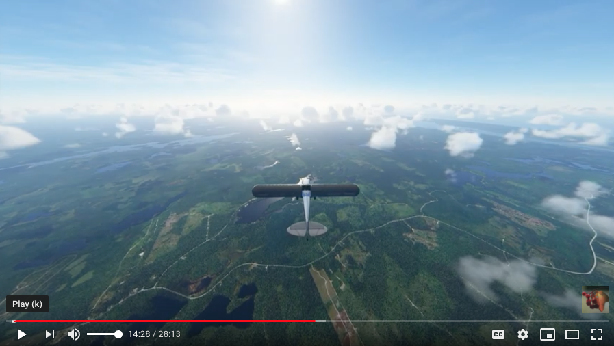
“On and on it goes west from KNP nearly to Digby, as far as the eye can see and that’s from an altitude of 2000 ft, where we can see a long way…there is literally more clearcut than forest, and what forest there is I do not know how much is actually ecologically intact”
 “…see all those green lines, that’s the trees planted in a row. The original biodiverse Acadian forest…has been systematically removed to be replaced by whatever species of conifer they decide will grow best there… we are about 1/2 way between KNP and Digby now and off our starboard we see more of the same thing”
 “Coming up is what appears to be a clearcut of a bit of private land…it’s narrow because they have been divided up parents to children over several generations… Just west of that narrow track we see a lake and a disturbingly expansive clearcut right around a substantial stream that feeds into it.”
“Just off my starboard fore is the small town of Digby. In the immediate environs, we are not going to see much more of clearcuts.. the timber pulp & cartels have gotten pretty good at keeping these things hidden. Even if they do put them in by major roads, they tend to leave concealing stands of tree so passers-by don’t notice them. If you think you are in a forested area, park your car, get out walk and 100 m through the trees. Odds are extremely good that you will find yourself standing at the edge of a clearcut
After landing, Cliff S. shares a satellite image of our route. “If we return to the original imagery, the satellite photos, this is the route we flew..it passes right through the north 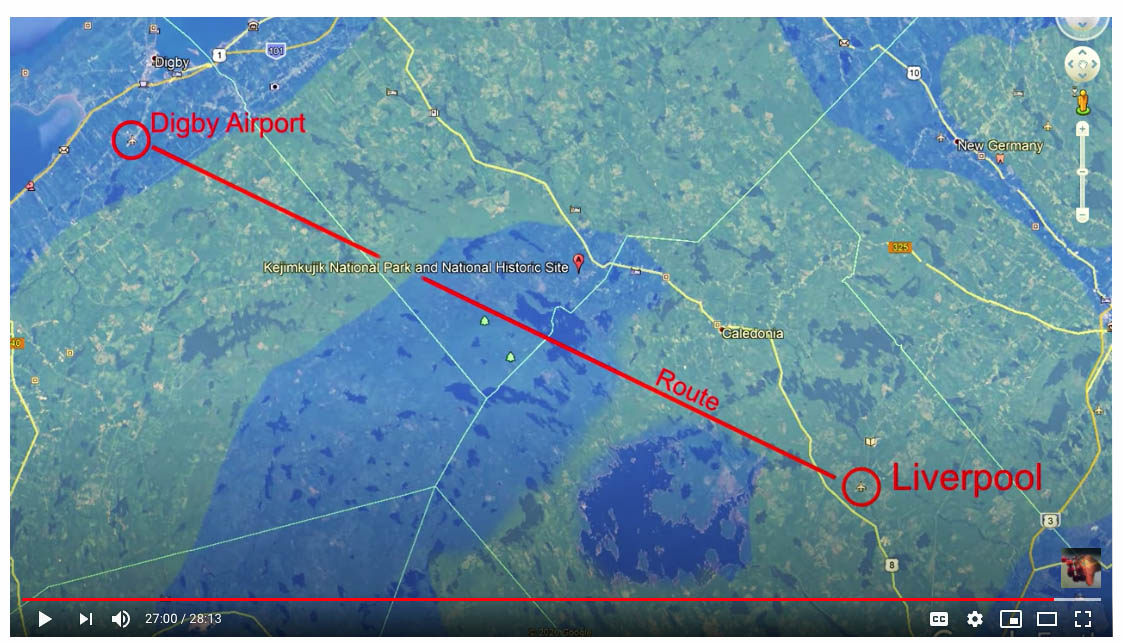 side of KNP. How much of this region has been almost entirely clearcut? I have highlighted it in yellow for you.
“The let-us-call-it “pristine region” is in the zoomed area, but if you want to see these old forests while they are still intact, you should hurry because if you look down there in the area that I am presently highlighting, you will see that now that the Timber and Pulp cartel have consumed most of the forest in the outlying regions they are rapidly pushing inwards and soon will have consumed all of the woodlands, I predict within a decade, right up to the boundaries of KNP.”
“This utter devastation is the fate of the Acadian forest and the forest through much of Canada and the world unless concerned citizens act now to protect them.”
Amen.
And Thanks for the carbon emission-free tour, Cliff Seruntine.
———
As I have noted before, good news about forests and forestry in NS is hard to come by these days. The last bit of good news was about a community group raising $80K + taxes (they are still at work on the taxes) to rescue 50 acres on the North Mountain from the chopping block. That hard-earned gain pales beside the publicly subsidized clearcutting of our Crown lands, so well illustrated by the latest Harvest Plan announcement. As I commented earlier today in an update to my previous post,
Clearcutting on Crown lands continues unabated… L&F just issued its summary of the latest Harvest Plan Map Viewer update (these are mailed to subscribers): 32 parcels/830 hectares most of it Variable Retention (clearcuts) and Shelterwood (typically 1st stage in a 2-stage clearcut), NO Irregular Shelterwood as recommended by Lahey. ‘Seems the mills are hungry and want to tie up as much of the Crown land wood supply as they can the easiest way they can harvest it just in case the Lahey Recommendations come into effect a year or two from now. At least that’s the way it looks.
Of course there are next to no restraints to how logging is conducted on private lands. And it seems L&F is watering down the Lahey Recommendations for Crown lands as much as it can and taking as long as it can to implement them; all the while, the status quo for Big Forestry’s access to the Crown lands remains in place.
So thanks again Cliff Seruntine for your efforts to help people see – at the ground level, via drones and now by satellite – what is happening to our forests in 2020.