
Fortunately, one doesn’t really have to understand all of the nuances of hierarchical landscape classification or of the debates about natural disturbance regimes to appreciate most of this work as a guide to the landscapes of Nova Scotia.
 An article in the March 2018 issue of Atlantic Forestry Review* alerted me that the latest version of DNR’s Ecological Land Classification (ELC) is now available online as a PDF document:
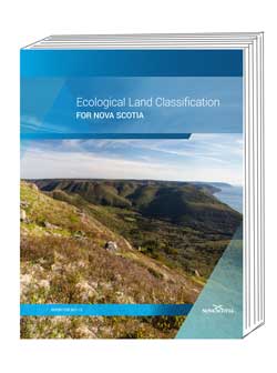
Ecological Land Classification for Nova Scotia, by Peter Neily, Sean Basquill, Eugene Quigley and Kevin Keys. Nova Scotia Department of Natural Resources Renewable Resources Branch Report FOR 2017-13.
As a short title, I am referring to it as ELCNS 2017 to distinguish it from earlier versions. There is not yet a PDF version available for the large map showing Ecoregions and Ecodistricts that is included with the print version but an earlier version (Map DNR 2007-2) is available as a PDF. As far as I can see, the only difference is that Ecodistrict 420 (Eastern Drumlins) has been dropped in the new version.
________________
* “The big picture, the finer details. Nova Scotia releases guides for ecosystem-based forest management”, pages 22-23 in Atlantic Forestry Review, March 2018.
After a quick look at ELCNS 2017 in PDF form, I put sent a request to nsdnrlib@gov.ns.ca for a print copy and requested also a print copy of the recently released Forest Management Guide. Here’s the info I received:
Thanks for your request this morning for two new titles. I’ve included the link for Nova Scotia’s Forest Management Guide, no print copies are being provided for this title.
https://novascotia.ca/natr/forestry/programs/timberman/pdf/FMG.pdfOur other new title: Ecological Land Classification is available for $10.00 + GST. The total charge with a shipping price added is, $14.53, but purchasing here at the Library [3rd floor, Founders Square, 1701 Hollis Street, Halifax] will result in the total, $10.50. In person you can pay with cash, cheque, or money order.
We’re now limited to using the Payment Centre for all credit card transactions, we need a bit of time to prepare the order, then call you, and transfer your call to our Payment Centre. We then mail the item to you.
The print version of ELCNS 2017 is a Coffee Table style, 8.5 x 11″ (22 x 28 cm) glossy, 296 page book; a large (58 x 84 cm; 23 x 33″) colour map showing Ecoregions and Ecodistricts is provided in a pocket on the back cover.
The short review: it’s definitely worth the $10+ for anyone interested in the landscapes and natural history of Nova Scotia at large. Of course it is available electronically as a PDF document as an alternative or supplement to the printed book. One reason I immediately wanted a print version was because the photos in the PDF version are pixellated even at the “actual size”, and there are some really nice landscape views and nature photos (mostly by acclaimed photographer Len Wagg) – on that score, I very pleased that the print version is 8.5 x 11 and not smaller. (I am guessing the pixellation in the PDFs is deliberate, so people don’t reproduce them digitally, and/or to provide an incentive to purchase the book.)
ELCNS 2017 is a successor to ECOLOGICAL LAND CLASSIFICATION for NOVA SCOTIA Revised Edition 2005, which is a 72 page document without the photos, piecharts etc, found in ELCNS 2017. The new document incorporates information from the Forest Ecosystem Classification (2010/2011).
ELCNS 2017 was was prepared by Peter Neily, Sean Basquill, Eugene Quigley and Kevin Keys of NSDNR with naturalist Zoe Lucas writing about Sable Island (Ecodistrict 850). Sean Basquill is the Provincial Habitat Biologist. Neily, Quigley and Keys are “foresters” in the Research & Planning Section of NSDNR Forestry, so it’s not surprising that ELCNS 2017 is strong on DNR Forestry perspectives.
Part 1 – Development of the Ecological land Classification for Nova Scotia, pp 9-42 provides some background on ELC as developed by DNR for Nova Scotia. I have always had a hard time getting my head around this stuff and I am afraid this treatment doesn’t help but I will keep on trying. There are pieces in Part 1 with pretty technical language which I think will lose a lot of those reading the book out of of general (versus professional) interest. An example: on page 15 it refers to “land system polygon attributes” with no explanation of the use of “polygons” in GIS procedures (nor are polygons defined in the Appendix 3 Glossary).
Most of the book is taken up by Part 2 – Descriptions of Ecoregions and Ecodistricts – and it is this part that could make the book a best seller of sorts. There are Nine Ecoregions, each designated 100, 200…900; and within each Ecoregion a variable number of Ecodistricts numbered at intervals of 10, e.g. for Ecoregion 300, they are numbered 310, 320, etc. There are a total of 39 Ecodistricts defined in ELCNS 2017.
Part 2 takes a sweep across Nova Scotia starting in Cape Breton proceeding towards SW Nova Scotia (Ecoregions 100 to 700) and then covering the Atlantic Coastal and Fundy Shore Ecoregions. Each Ecoregion is introduced in a couple of pages, and is followed by descriptions of each of the Ecodistricts in the Ecoregion with an intro and sections on Geology and Soils, Forests, and Non Forests and a ‘Sample area map showing typical ecosections found in this ecodistrict’. There are many aerial photos, most by Len Wagg, which give a visual sense of each Ecodistrict.
So the Ecodistrict descriptions and photos provide a kind of aerial tour of the province with descriptions of features that can be distinguished from perhaps 1000ft above: “In general, ecodistricts are discernible as distinct, large-scale, physiographic areas that can be used to separate uplands and lowlands. They may be further defined by landform pattern, surficial and/ or bedrock geology, soils, water bodies, or vegetation within the larger ecoregion.” – ELCNS 2017, p 17.
At the level of Ecoregions and Ecodistricts, the classifications and interpretations are fairly general and likely not too controversial scientifically. Once we drop into the next level downwards – Ecosections – however, matters get more complicated as it is at this level that NSDNR provides its controversial interpretations of natural disturbance regimes and forest succession which in turn, in principle at least, are applicable to forest management, also to conservation planning. While the detailed mapping of Ecosections and distrurbance regimes are not given in ELCNS 2017, they are available on the Nova Scotia Landscape Map Viewer.
Unlike, Ecoregions and Ecodistricts which correspond to specific geogaphic areas and are not repeated across the landscape, Ecosections are units that can be repeated across different Ecodistricts, likewise for the finest level of discrimination of the landscape – Ecosites – for which there is not currently a comprehensive mapping available.
Things get really complicated conceptually in Part 1, page 20 ff where two “Ecosite Groups” are described, the Acadian group and the Maritime Boreal Group. As well as 28 Ecosites falling in one of the two groups, so also the nine Ecoregions and their associated Ecodistricts fall into one of the two Ecosite Groups…. so at the Ecosite level, the lowest level in the hierarchy, they kind of climb back up the hierarchy and make new groupings above the Ecosite level. Clear as mud?
Fortunately, one doesn’t really have to understand all of the nuances of hierarchical landscape classification or of the debates about natural disturbance regimes to appreciate most of this work as a guide to the landscapes of Nova Scotia. As such I expect ELCNS 2017 will be a popular item.
————-
Still to come in NSDNR’s roll out of updated guides: Ecological Landscape Analysis documents – I have been told they are coming but DNR doesn’t have a timetable for that yet (e-mail from DNR official, Jan 25, 2018).
More info about the direction of NSDNR’s to-date rather elusive landscape level planning is given in the Atlantic Forestry Review article:
These [ELCNS 2017] classifications are intended to provide a framework for landscape-level planning. “We are currently developing the procedures through a pilot project at Port Hawkesbury Paper which is expected to wrap up later this summer, and then we will take what we’ve learned from that and write a landscape planning manual- and at that point we’ll be ready to begin discussing how to do landscape planning with various parties,” says Stewart. “We’ll have to engage private woodlot owners, industry, probably municipal governments – anyone who has an interest in how the landscapes are managed. And the various values, whether they’re recreation or wildlife or timber or whatever – they all have to be balanced.”
Nice to know. The landscape level planning (or the absence of it) for the Port Hawkesbury Paper managed Crown lands ran into a few snags recently, ‘hope they learned something from it all! (We are still waiting for a formal report on it all from NSDNR.)
The Atlantic Forestry Review article also refers to a “new digital soil map”. I looked for it on NSDNR website without success e.g., it’s not listed under a Soils and Water page or on a page I hadn’t seen before: Tools, Under Ecosystem Management:
This toolbox provides materials and links that support Ecosystem Management in Nova Scotia. Landscape Level policies, guidelines and mapping tools provide a framework for planning and delivering ecosystem-based management; describing ecological processes and structures; and assigning land use intensities.**
‘Would be nice if there were a page “What’s New at NSDNR Forestry”, and perhaps another on “What’s ahead at NSDNR forestry”.
——————————————————————–
**Received from Peter Neily, NSDNR, April 3, 2018:
The soils mapping is available here:
https://novascotia.ca/natr/forestry/programs/timberman/pta.asp
On that page you can Download FEC Soil Type Data in Shapefile (700 mb zip file) or ESRI File Geodatabase (500 mb zip file) format
OR you can view the FEC Soil Type and Wind Exposure data online in the Pre-Treatment Assessment Reference Viewer ( a new one for me). Example:
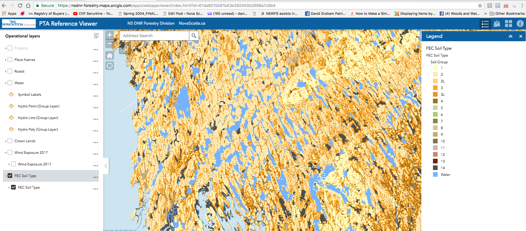
View FEC Part II: Soil types for description of the soil types.
Thanks Peter