
[Post updated Nov 13, 2016: Global Forest Watch images added.]
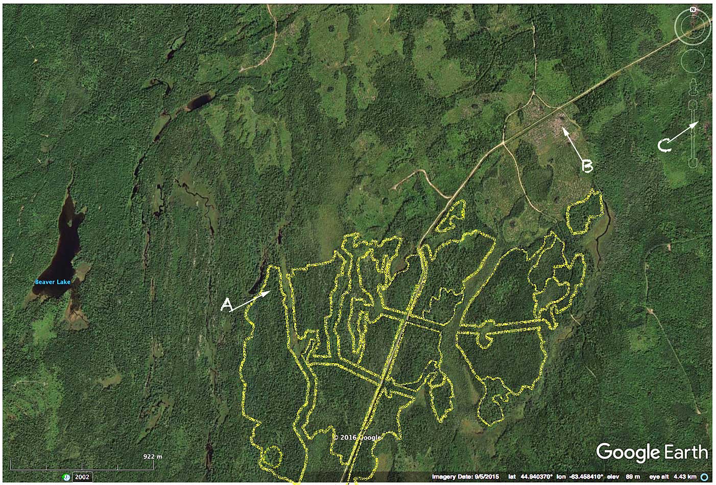
Crown landscape approx. 5 km northeast of Halifax Airport. Yellow lines are approximate boundaries of Block ID HX060122 for which a clearcut is planned. A, B and C refer to the landscape views below. The landscape has been intensively cut to the north and northeast.
Have a look at the much touted vehicle of transparency around cutting on crown land in Nova Scotia: the Harvest Map Viewer (or go to the cover page for the viewer). Pick one of the those dark blotches, zero in and have a look. I did.
Then I looked on Global Forest Watch and Google Earth to see what else had been clearcut on the same landscape in recent years. (You can also go directly to the area in Google Maps). It wasn’t comforting.
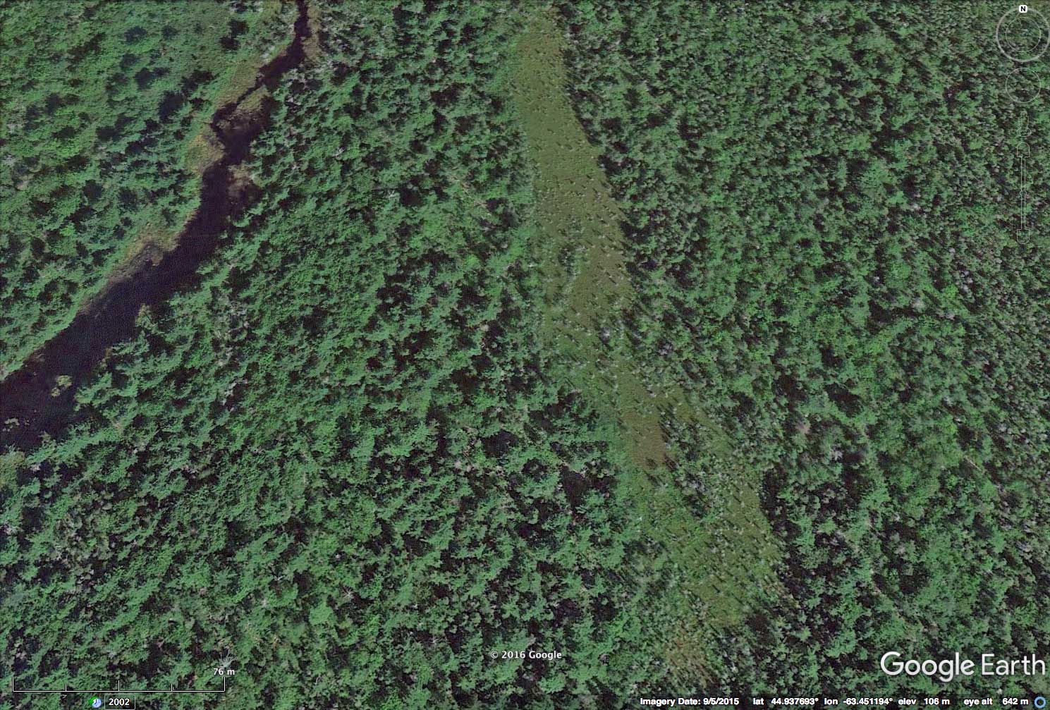
Landscape View A, area to be clearcut, excluding the wetland. Click on images for larger versions.
The planned and recent clearcuts do not mimic any natural disturbances on Nova Scotian landscapes that I know of – at least not since the last glaciation – and it’s hard to see how natural ecosystem structure and function will be sustained.
“Extensive forest lands will be managed for resource production using techniques that mimic natural disturbances and sustain natural ecosystem structure and function.”
– NS Code of Forestry Practice
Perhaps the wetlands are all ombotrophic bogs operating as self contained closed systems hydrologically and will be unaffected by clearcuts. (Forget about intact forest canopies which, apparently, don’t count.)
I suppose I could request the PTAs for the 18 separate pieces in the 154 ha Block ID HX060122 to find more out about the sites and the planned harvest. I did. But I don’t know if I will receive them before the Comment Period expires, partly because I can’t find out from the information given when it closes. (The website states “Each map also includes a closing date for public comments on each of the proposed harvest sites, which is 20 days after the harvest site is first posted”, but as far as I can see, the Closing Date – or the date the item was posted – is not actually given on the Maps.)
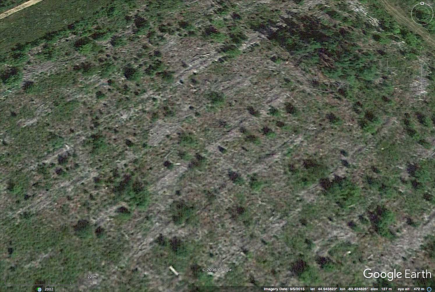
Landscape View B, recent clearcut.
Then once I have received the PTAs, I may have to hire a consultant to understand them (as Linda Panozzo was advised in relation to Forest Inventory info), conduct a field trip to ground truth it all and then assemble a team of experts and probably some lawyers to make a case for the obvious: these harvests are not mimicing natural disturbances and sustaining natural ecosystem structure and function as directed under the Code of Forest Practice. (The Code of Forest Practice “is mandatory for application on Crown land”.)
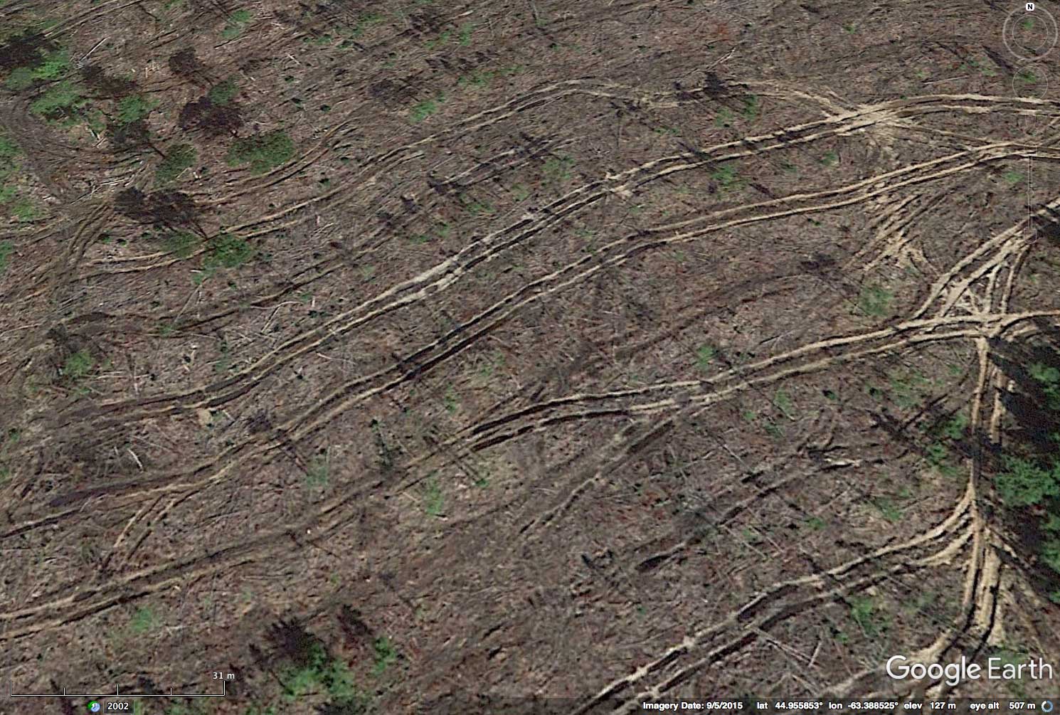
Landscape View C, recent clearcut up the road.
In any case, one has to assume The Fix is In. Since 2001, the harvesting machines have been moving southwest towards Block HX060122 chewing up large blocks of forest like dinosaurs on a prehistoric landscape. (At least that was a landscape and flora and fauna that coevolved with dinosaurs.)
If the government/NSDNR were serious about transparency and perhaps, about involving the public in the management of public lands, they would tell us what they plan for next year, not just 20 days from now. They might even share their plans and projected harvests for 2, 5, 10 and 25 years ahead.

Global Forest Watch images showing Loss of Tree Cover (pink) over intervals given & Gain of Tree Cover (blue) 2001-2012.
Most of the Gain (blue) is in land clearcut prior to 2001.
Click on image for larger version
Thinking about it, I have to wonder if there are any plans beyond the 10 years covered by recent fibre allocations for SW Nova Scotia.
“We have now developed tools that ensure that all harvest treatments are aligned with the nature-based requirements of Nova Scotia’s lands.”
– Five-year Progress Report on the 2011-2020 Natural Resources Strategy
——————
On the Harvest Map Viewer itself
The Viewer works well mechanically. (It is robust.) A layer with Protected Areas has been added so the proximity of cutting to Protected Areas can now be discerned. What’s needed are some layers with older clearcuts, e.g., going back to 2002, as can be viewed on the Global Forest Watch site (but those may not be entirely accurate on a very local scale; they seem to refer some cuts in the early part of the time frame to Tree Gain). The date on which a block is posted and the date on which the comment period closes should be given. I don’t see why the posted blocks couldn’t link directly to PTAs rather than having to request them; having to request them lends an air of “we are watching you” to the process and reduces the time an interested party has to review a planned cut. A video-tutorial on how to use the Viewer would be helpful. (I have submitted these comments to NSDNR.*)
*A very positive response to all suggestions was received 15 Nov 2016.
The Global Forest Watch images at right can also be viewed sequentially.